East of Shoreham, beyond the Darent Valley wall, is a quiet area of dry valleys, grassland, farms, woods and hamlets. Unlike the west side, the M25 is inaudible. There used to be a golf course but that’s now disused and has reverted to a wildlife-rich habitat. So when I say quiet, I mean forgotten, mysterious, ignored, but atmospheric and attractive. It’s great for a stroll, especially if you are after a little solitude; it seems to be off the beaten track for most walkers. One thing is the high humidity of the Austin valley which ends at Magpie Bottom. It definitely has a microclimate – you can feel it. The wildflowers in summer here can be superb. My walk is easy to follow and has some lovely views, but has three steep sections. There’s history too: bomb craters, deneholes, ancient ridgeway routes and the spot where the aviation pioneer Percy Pilcher tested gliders in the late 19th century (short detour just before point 6). It connects with Walk 5 (Romney St) and Walk 19 (Fackenden Down) and can easily be adapted to join on with any of the Shoreham walks and also the Eynsford/Lullingstone route. No need for a car; the walk starts right by Shoreham station.
Getting there: Easy. Trains: Southeastern/Thameslink trains stop at Shoreham (direct from Elephant/Denmark Hill/Nunhead/Peckham Rye/Catford etc). Also, Arriva Kent 403 bus from Tonbridge/Dartford stops at Shoreham. If arriving in Shoreham by car you can park in Station Rd or at the station itself (I’m not sure whether you have to pay – probably not on Sundays at least). An alternative way to start the walk is to take the footpath behind the church (rather than walk up Station Road), cross the railway line at the pedestrian crossing a 150 metres past the station then take the footpath just to the left on the opposite side of the A225 (shown as ‘Alt route from the village’ on the map above, description below).
Starting point: Shoreham railway station
Distance from SE London: 45 min drive from Sydenham, 40 min by train from Peckham Rye station (on Thameslink)
Refreshments: The Samuel Palmer, Shoreham (opposite the church you can see from the station), The Mount Vineyard (turn right a few metres past the Samuel Palmer). Further on are two more pubs, the King’s Head (temporarily closed since March 2022) and The Crown.
Download a pdf (to print out) of this superb chalk uplands walk
Click here for GPX map at All Trails and at Ordnance Survey
Covered on Ordnance Survey Explorer 147 map
The walk (2 hrs/4.5 miles)
The route in short:
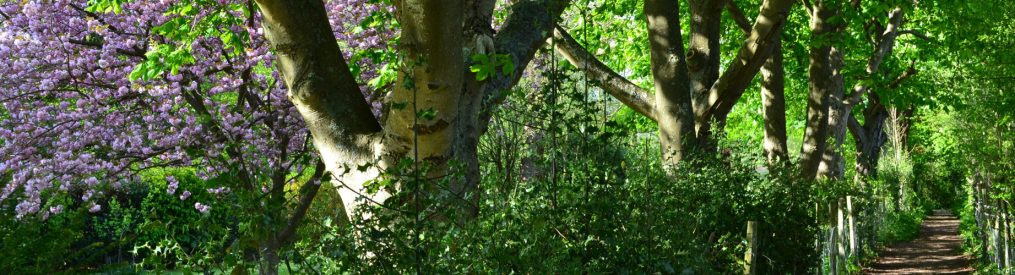
Points 1-2: 675m. Leave Shoreham station, cross the main road (A225) and take the broad signposted footpath nearly opposite Station Rd (but slightly to the right) heading uphill east. The slope is shallow at first. After 190m or so ignore a path forking off to the right steeply uphill and continue straight on (or on the left, depending on your perspective) through mature beech and sycamore woodland. Soon the gradient becomes steeper and the path climbs the hillside sharply with a long series of steps. Near the top (but not at the top) you’ll hit a path ‘crossroads’ (point 2).
Point 2-3: 900m. Turn left on this path so you are heading roughly north just beneath the plateau at the top of the hill with fields just beyond the treeline on your right. The path seems to split after a few hundred yards but keep to the right and the path staying higher on the hillside. Soon this path goes along the edge of a field where it is quite overgrown (especially in June) – a sign you are on the path less travelled. After 300 metres or so it re-enters woods (now more east than north); don’t take any path heading off to the left, keep right; soon you reach another path junction (point 3).
Point 3-4: 1.3km. Take the path bearing right (north-east). (Straight on would take you to Eynsford, left would take you back to Shoreham village.) You’ll see a field directly on your right and soon, to your left as the woods becomes less tangly is an impressive cluster of European Larch trees (a deciduous conifer) which puzzled me until I realised that some conifers do indeed shed their ‘leaves’ in winter. Buzzards are often seen here. Now, the path emerges from the woods into a field to the left (NOT the field on the right); follow the path diagonally through the field then increasingly downhill to woods. Here, there are steps because it’s pretty steep; soon, follow the path to the right (east) as it passes through a ‘tree corridor’. To the right, the now overgrown defunct Austin Lodge golf course can be seen for the first time – rewilding itself nicely. At a path crossroads in the tree tunnel, turn left across grassland. You are now at the bottom of the dry valley heading north. Soon you’ll hit a lane that leads to the defunct club house (this lane is point 4).
Point 4-5: 770m. Cross the lane and take the sometimes overgrown footpath opposite to a lane by the hamlet of Upper Austin (on the left is some scrap land that will apparently be built on, there used to be a black barn on it). Walk through the hamlet (interesting dairy and stable conversions and finally a house with a beautiful glass extension) then take a left fork which becomes the footpath again past an interesting, large newly built home called Greenways heading south down a valley (there’s a ‘private’ sign here that might confuse, but don’t worry – you are on a public footpath). Again, you are passing the overgrown golf course. To the right, up the hillside (watch for the sign) on yet another overgrown path, is a memorial to Percy Pilcher who flew his manned gliders here in the late 1890s and nearly beat the Wright Brothers to powered flight – a story that’s not really come to the public’s attention much. It’s a superb viewpoint but a 15-minute detour. If you don’t take the Pilcher detour continue south on the path until it takes a sharp left through a hedgerow/tree corridor going gradually uphill; up ahead is private property (‘do not enter’ sign) now wonderfully rewilded (this is point 5). (If you had taken the Pilcher detour just retrace your steps down the hill and turn right at the bottom until you reach the aforementioned hedgerow corridor heading uphill east.)
Point 5-6: 1.3km. Take the tree corridor (as mentioned, a sharp left), heading east, noting faded old yellow Fox and Hounds waymarker. After a few hundred metres the path steepens and bends south again (two stiles at this point, only one of which you have to climb over). There are brilliant wildflowers here with lots of orchids in June. There are nice views over Round Hill and the old golf course to the right at this point. Keep going. Beyond the trees on your left, at the top of the ridge, is a large field which hosts an airstrip (maybe defunct now as of summer 2022). If you are lucky, a rather elegant vintage red light aircraft will take off and do circuits. Eventually, after a dip, you’ll see, to the left, some buildings. This is Romney St. (Turn left if you like to view the disused Fox and Hounds – a legendary pub which once served a Luftwaffe pilot who’d crash landed near Shoreham – or if you’d like to extend the walk to take in Fackenden Down.)(point 6).
Point 6-7: 1.2km. You’ve noted the house on the left and you are now at a path crossroads; left (as mentioned above) is the closed Fox and Hounds down a path hemmed in by hedgerows; ahead is the path leads to Magpie Bottom (I suppose). We are going to turn right (west), however, with a fine view ahead of us as far as Canary Wharf and the Shard ahead slightly to the right. The path opens out on to chalk upland. Continue on path through a shallow dip then through a gap in trees/hedges and down a very steep hill (northern part of Round Hill) where the golf course used to be on floor of the deep valley – part of Magpie Bottom. Pass through hawthorn ‘corridor’ then go up very steep hill to copse (behind you enjoy the view of the valley with the lake as pictured below). Leave copse, walk diagonally across field then another larger field to join farm track (point 7).
Point 7- back to Shoreham station: 1.2km Turn right on this track and through yet another dry valley (much shallower, thankfully, than the previous one) to Dunstall Farm. Turn right at farm buildings and just before a circular cattle barn (Roundhouse, cattle supplied to Castle Farm), turn left on a signed footpath across field to woods and point 2, down the steps you walked up 2 hours previously, through the woods and back to Shoreham station. Lovely.
Pubs and cafes on my north-west Kent walks
Alt route from the village: The benefit of this is that you avoid walking up Station Road and also that you won’t repeat any part of the walk if you follow it. Start at the churchyard opposite The Samuel Palmer pub (very atmospheric; beautiful wooden archway, flint church, yews) and exit via gate into a field with the train station visible ahead. Turn left on the path and continue to the end of the field when you turn right on a path heading towards the railway line. Cross the railway (CAREFUL!!) by a pedestrian crossing and walk up to the main road. With great care cross this road (A225), and turn left along the verge a few yards then take the signposted public footpath into a large field. Remain on this path (it diverts around a house and drive at one point) and follow it through tangled woods overgrown with creepers as it steeply climbs the eastern valley wall to Point 2 (path cross road). Then follow the route described above.
Reflections on this walk
I first did this walk properly in January 2017 on a cold, very clear day. There was plenty of frost, still intact at 2pm, and even the odd stretch of patchy snow, left over from the slight fall of Thursday evening, January 12. I didn’t pass a single soul the entire length of the walk, nor did I come across anyone when walking through the hamlet at Upper Austin Lodge. Without the distant rush of cars on the M25, audible from other walks in this area, there was pervasive silence only broken by the calls of a pair of buzzards I disturbed in the larches at Point 2 and the venerable light aircraft that reared up suddenly from the private airstrip at Romney St. I’m not great at identifying trees – in the late summer I had got as far as Point 2 (I admit it, I got a bit lost so didn’t complete the whole walk) and hadn’t looked too hard at the larches, just clocking them as conifers of one sort or another. But this time I noticed they’d shed their leaves/needles, and realised they weren’t cypress or pine. I had forgotten there was such a thing as deciduous conifers.
The overall colours of the day were brown and blue; the light was an Impressionist’s dream, as some of the photos hopefully convey. The topography of dry valleys (the streams that made them disappeared into the underlying chalk post ice age), hillocks, plateaus and long ridges were a constantly shifting backdrop of surprising contours – gentle declines suddenly steepening; the path nurtured by the shapes of the landforms.
The decaying golf course has become an unofficial wildlife preserve. Nearing Romney Street I saw in the valley below a strong, healthy looking fox setting out on a hunt across an old fairway. Urban foxes are far more shifty and mangy creatures. This was a fox from children’s story; bright red with full, bushy tail, on the trail of a pheasant, unconcerned by the possibility of car, pedestrian or dog. I wonder what will happen to that land; it’s perfect just now, unkempt but still open.
Rather like the golf course, the handsome Fox and Hounds pub is shut up and slowly decaying. A great shame, but somehow emblemic of this, as I say, mysterious little area.
In summer the route is just brilliant for wildflowers including orchids and sainfroin and lots of hedgerow birds such as yellowhammer, blackcap and whitethroat. A little secret: between May and September this is my favourite walk at KWNL – especially when extended to Fackenden Down and even across the Darent Valley to Meenfield wood.
Shoreham
Pubs and church
There are a lot of truly lovely buildings in this atmospheric medieval village. My regular pub is The Samuel Palmer (formerly Ye Olde George) which was heavily and tastefully renovated during Covid. It is owned by the superb Mount Vineyard, 50 metres further into the village. Both serve top notch food – pizzas at the vineyard, fine dining and great snacks at reasonable value at the Samuel Palmer. The Crown is an excellent pub in another superb old building, as is the King’s Arms, now reopened after a fire early in 2022.
The Grade I-listed church, made of flint, brick and wood, is definitely worth a visit. It really is the quintessential English country church. There’s a very Vicar of Dibleyish YouTube vid for it here. The churchyard, with its line of yews and eroded gravestones, and aged wooden entrance is very evocative of the rural past. Here’s a beautifully written blog, paying homage to Shoreham and the valley, and Samuel Palmer. There’s plenty more of interest in the village – Castle Farm and its stunning fields of lavender (en route to Lullingstone – a superb farm shop too with renowned beef, dried flowers etc), the Shoreham Aircraft Museum on the High St (so many of the villages of this area keep the memory of the Battle of Britain alive).

Donations
If you’ve enjoyed one of the walks on this site and feel it’s enriched your day, feel free to make a small donation here if you wish. It'll encourage me to add more walks, update information and work harder to improve accuracy and quality. Thanks a lot.
£3.00
Can also combine with Walk 16 and Walk 19
Places of interest en route or nearby
Lullingstone Country Park/Visitors Centre


