A lovely chalk country walk along meadow edges and through woods, with a finale among giant conifers on the old estate of John Lubbock – a great Victorian scientist and friend of Charles Darwin. This is one of a suite of walks extending back from the North Downs escarpment to the south and west of the A21 including the Downe, Knockholt Pound, and Cudham routes. No stiles or steep slopes (but a few steps at one point). Nothing too dramatic, but highly civilised! The final mile can be very busy with dog walkers and visitors to High Elms.
How long from SE London? Drive time from Forest Hill is 35 minutes. If you’re not driving, you can take TfL’s frequent 358 bus to Farnborough village from Bromley South, Orpington, Crystal Palace, Shortlands, Kent House, Eden Park, Anerley, Clock House stations etc (the start point in Farnborough is only 16 minutes’ bus ride from Bromley South). The closest railway station is Orpington, just a mile or so from Farnborough village.
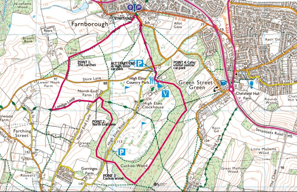
CLICK HERE FOR GPX MAP OF THE ROUTE AT OS
Start: Tye Lane (by church), Farnborough village (Kent – not the Surrey one!!). But if you prefer, you can park in the High Elms visitors‘ car park (Point 4 on the maps) a mile away and start from there.
End: Tye Lane/High Elms visitors’ car park.
Pub: The Woodman in Farnborough village seems pretty friendly
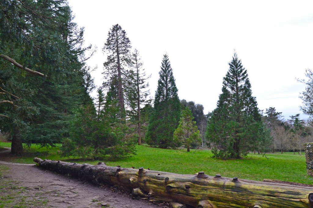
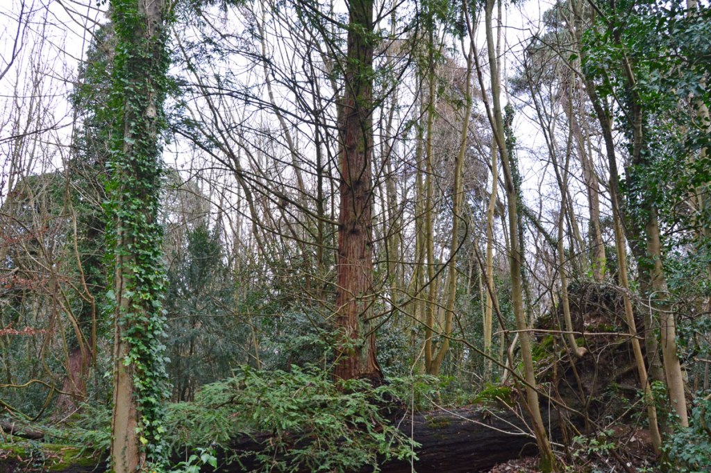
What will I see?: Wonderful ancient woodland, wildflowers including orchids in spring and summer, the remnants of Lubbock’s High Elms gardens and arboretum.
Refreshments: Green Roof café at High Elms next to Beeche visitor centre; the Change of Horses or the aforementioned Woodman pub in Farnborough village.
Much wildlife? I’ve seen plenty of bats outside of winter on this route on warmer evenings. Kestrels, long-tailed tits, buzzards, red kites and goldcrest are reasonably common and deer can usually be seen somewhere en route. On my last dusk visit I did not hear or see tawny owl sadly, but there must be some around. Too many parakeets, however.
Difficulty rating: Easy enough for sturdy pushchairs (no stiles), but one dangerous road to cross (Shire Lane). Some steps up to a raised path soon after crossing Shire Lane but this can be avoided by taking the parallel bridlepath on the sunken holloway.
Click here or on the map below for an Ordnance Survey GPX of the route (providing real time location by following the arrow that appears after you touch the compass icon).
Click here for PDF to print out or download
DIRECTIONS
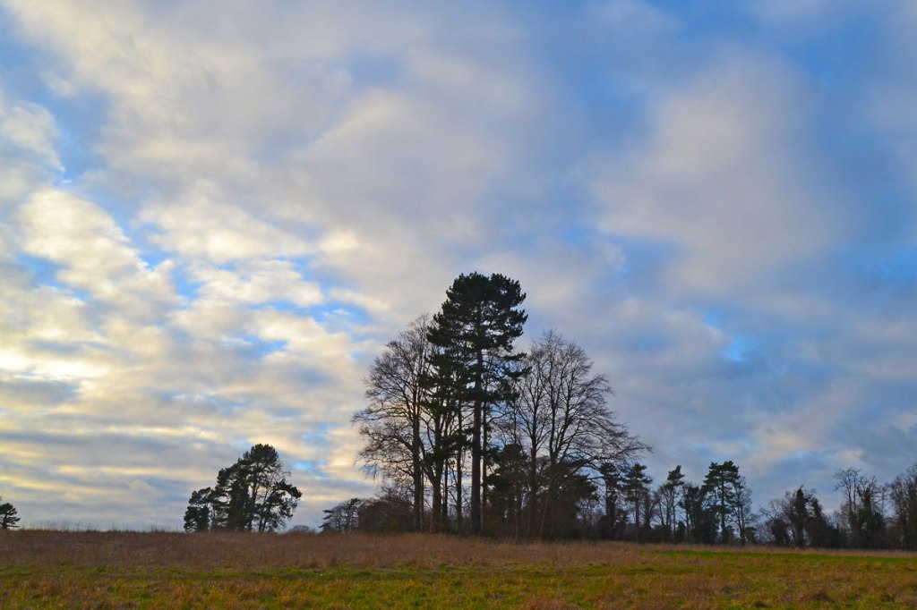
START to Point 1 1km From Tye Lane walk south-west on the upper edge of a large scrubby field to woodland called The Larches (ignore paths off to right and left). This is Point 1.
Point 1-2 2.5km After continuing through The Larches for 200 metres, take the path on the left heading south down the right-hand edge of another field to Shire Lane. Turn right on busy Shire Lane (TAKE CARE – NO PAVEMENT!) then almost immediately take the path opposite heading south through a very large field, now uphill slightly. After 500 metres you’ll reach a path junction. Here, turn sharp left (east) – best to follow the path up some steps along the side of the field rather than use the muddy sunken bridleway that’s parallel. After about 1km you’ll reach North End Lane. Here, turn left (north-east) for about 100 metres on the quiet road then turn right on a path entering woodland (the High Elms estate). This is point 2.
Point 3-4 1km Follow the woodland path for maybe 50 metres then take the path on the right, heading south, still in woods. Follow this lovely path passing many interesting trees, such as holm oaks, for several hundred metres. There’s a dene hole on the right soon after entering these woods. Note how eventually the path, as it turns left (south east), twice passes electricity cables carried on pylons. The path then reaches High Elms Rd (point 3).
Point 4-end 3km Cross the quiet road and take the path opposite through Cuckoo Wood (still High Elms estate). Follow this path through woods south-east; ignore the major path heading left (it doesn’t really matter if you take this by mistake – it shares the same destination) and follow the path you’re on as it descends slightly and curves to the left, now heading north. You pass a woodland meadow on the left with great wildflowers April-August. Soon afterwards note the Beech Walk on the left, with trees planted in 1840 still there, though some have been lost. Continue all the way to the main High Elms gardens, the Beeche visitor centre, Green Roof café and car park. This is point 4 and the alternative start/end. To continue back to Tye Lane, take the path in the bottom right of the car park, cross Shire Lane, and walk uphill on the path opposite for 150 metres or so, passing the original spot where the graves of the Lubbock family were. They are now in the churchyard of the medieval church of St Giles the Abbot; walk through the interesting churchyard to Tye Lane. Voilà.
Bromley Council has a leaflets for the Lubbock’s Landscape walk and a High Elms Estate Walk (similar to the above described route but a mile or so shorter) here.