Distance from SE London: 35 minutes’ drive from Sydenham
Walk highlights
Wildflowers galore from orchids to marjoram and wild thyme and basil in summer. Lots of butterflies and more yellowhammers (a type of bird!) calling than I’ve heard anywhere on the planet. Great views all year round and lots of oasthouses too… the architecture that just screams ‘Kent’. Meanwhile, Spitfires fly back and forth overhead, giving joyrides from Biggin Hill airfield. And this route also takes in the dwarf planet Pluto … I’ll explain later.
Tell me more
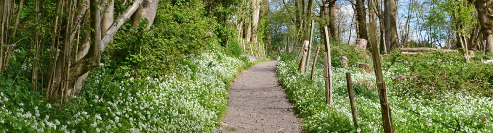
Shacklands Rd/Andrews Wood car park near Halstead is a good spot to leave the car and head for walks into the Darent Valley. Being so close to the M25 the early stages of walks are accompanied with the rushing sound of traffic but the compensation is superb woodland, a lovely chalk dry valley and, soon, great views over Shoreham and towards Sevenoaks. One of the highlights of this walk is the Kent Wildlife Trust’s Polhill Bank, a steep south-facing slope full of wildflowers and attendant wildlife in summer. Andrews Wood car park is about 35 minutes’ drive from Sydenham; for Otford/Shoreham station use the Thameslink service on the Peckham Rye line (about 40 mins). This route is very good for birds and butterflies, probably because of ancient hedgerows and wild meadows. The walk is lovely between April and November, maybe a bit too muddy at points after that. No pubs on the route of the walk but Otford and Shoreham village pubs are within a kilometre at point 4 and point 5 respectively.

View of Fackenden Down from the Polhill-Pluto walk
Can I take the train to this walk?
Yes, but you’ll have to walk a bit further (see blue lines on Google Map below). Like all the Shoreham walks here, it’s easy to adapt and improvise. Take the train to Shoreham station and do this website’s Shoreham circular walk but switch to this route instead after a mile or so at point 5 (Water Lane, which is between points 5 and 6 on the Shoreham circular walk). It’s further to joint the walk from Otford station but if you’d like to do that walk down the village high street heading west from the station. After about 800 metres you reach the River Darent. Keep going and take the first path on the right (by the Uranus scale solar system marker) after the river (about 200m past the river). This path after about 900m brings you to Point 4. (If doing this route as a train walk there’s obviously no need to go to cross the bridge over the M25 to Andrews Wood car park – just stay on the Andrews Wood paths without going over the motorway pedestrian bridge or keep on the path in Meenfield Woods, it’s not complicated.)
Download a PDF of this walk to print out
For a GPX Ordnance Survey map of this route click here.
GPX map at AllTrails click here.
The walk in detail
START Shacklands Rd/Andrews Wood car park off Shacklands Rd, at, err… Badgers Mount.
Point 1-2 (1km)
Plonk the jam jar in the Andrews Wood car park (confusingly called Shoreham Woods by Sevenoaks council). Cross the bridge over the M25 into mixed woodland. Follow the path as it bends to the right (south) just past a bit of wooden fencing (ignoring the path that goes straight on). Here, the woods become mainly of beech trees – notice how the undergrowth thins out, which is because beech trees ‘control’ undergrowth with various natural substances. Excellent bluebells here in April. After a couple of hundred metres in the beech woods, emerge from the woods at a gate into an attractive semi open area above a dry valley planted with hawthorns. You are still quite close to the motorway on your right. Follow the path straight on heading downhill (rutted in summer; waterlogged in winter!) then cross the valley floor with its little spring, heading east then uphill and join the main Polhill north-south path on the top of the ridge by a large field with a superb view over the Darent Valley. This is point 2.
Point 2-3 (1km)
Turn right on this path (south) immediately entering Pilots Wood. Unlike Meenfield Wood, which is beech, this is mixed woodland so more untidy-looking with a great variety of trees including pines, yew, oak etc. Note a second world war bomb crater on your left (probably a bomb dropped by a Luftwaffe plane escaping fighter attack during the Battle of Britain, with RAF Biggin Hill only a few miles away). Ignore a broad path off to the left which actually goes nowhere, and continue south. Soon you reach another bridge over the M25. Walk past this – do not cross it – and follow the path downhill to the left (south east), soon emerging onto Polhill Bank and its lovely view. This is point 3.

View from Polhill, July.
Point 3-4 (1.2km)
Turn right (south-south-east) on Polhill Bank to take the path straight down the steep hill itself, on its right-hand side (not the path heading east that descends slowly along the top). This path is quite hard to discern but it’s to the right of the bench, down the steepest part of the hill – you can see where it continues at the bottom of the hill so aim for that. In summer note the profusion of marjoram. At the foot of the hill ignore the path path off to the left (east) and pass through a gate and follow the path south-east with a hedgerow on your left and meadow on your right. Note the Charing X to Sevenoaks/Hastings railway line emerging from its tunnel on the other side of the large meadow. Great wildflowers and hedgerow here… home to butterflies and lots of other wonderful things no doubt. Cross Filston Lane and continue through a gate south-east admiring the oast houses of Sepham Farm. Soon the path passes this farm’s old curvy brick wall. Just past the farm at a t-junction with a large field of cereal ahead of you, turn sharp right (south-west) then left (south-east) to continue towards Otford. Just before the path enters a small wood note the path heading north-east towards Filston Farm and Shoreham that you’ll be taking. This is point 4.
Point 4-5 (1.3km)
At point 4 turn left towards distant oast houses of Filston Farm. Soon you will come across Pluto… the furthest point of the brilliant scale model of the solar system which starts in the centre of Otford with the sun and the inner planets. (It takes on a couple of minutes to walk from the sun to Mars in Otford’s recreation ground… but Pluto is 40 minutes’ walk further on… an impressive demonstration of relative distances in space.) The path skirts around Filston farm buildings then hits Filston Lane once again. Continue north on the grass verge for 200 metres until you reach Water Lane and point 5.
Point 5-6 (1.3km)
Walk up the track opposite Water Lane (heading west), passing though a gate on to a grassy hillside. Now things become steep as we regain the height lost by going down Polhill Bank earlier. Take it easy and walk up the hill. There are choices: walk all the way up the side of the hill as on the GPX map; or cross the field diagonally to arrive back at point 2 (from where you can walk back to the car park the way you came for a short cut). To follow the route on the map above and the GPX, take the broad path nortward on the top of the ridge through Meenfield Woods. Continue through these lovely beech / yew woods and after about 500 metres notice a ‘pine avenue’ then a junction of paths (right or straight on for Shoreham; left for Andrews Wood). This is point 6.

Darent Valley view from field above Filston Lane in autumn
Point 6-car park (1km)
Just after the short stand of pines turn left (west) and head quite steeply down through the woods, emerging into the dry valley encountered between point 1 and point 2. Here, the valley is pasture, quite unlike the more shrubby open-woodland-appearance we saw earlier. Cross the valley and then uphill, entering Andrews Wood through a gate. Follow the path through the woods towards the M25. It bends left soon and then you’ll see the bridge back to the car park.
Wasn’t bad was it?
Refreshments
Not en route sadly but three fine pubs within reach by a diversion or on the way back to Shoreham station are the Samuel Palmer, King’s Arms and The Crown, all in Shoreham, about an extra mile diversion.
More great Shoreham (Kent, not West Sussex!!) walks

Comma butterfly at Polhill
