This lovely route – one of my favourites – is all about sandstone springs, oasthouses, berry-filled hedgerows and prime woodland clinging to the ‘cliffs’ of the Greensand Ridge south of Sevenoaks with glorious views across the Weald to the Ashdown Forest. There is a shorter version too (detailed below). Some of it is horrendously muddy in winter though.
Access: Car needed, or taxi to Underriver from Sevenoaks or Hildenborough railway stations. Refreshments at the White Rock Inn, Underriver (check if it’s open; closed during Covid crisis but says it could reopen whenever landlord decides the time is right).
Dogs: Not suitable… possible encounters with farm animals and farm dogs, also dangerous slopes for more active animals.
Covered on Ordnance Survey Explorer 147 map
Distance from SE London: 50 min drive from Sydenham (via M25 and A21)
The walk (2hrs/5 miles)
PDF for Underriver walk download and print out here, or use this page on your smartphone
Click here for GPX map at Ordnance Survey to check location in real time
I’m cheating a bit with this walk… it’s a combination of the ‘scenic’ option for finishing One Tree Hill routes Walk 6 and the middle bit of Walk 7 but it’s a lovely way of covering ground you may have already walked but in a different way and with a different start and end point.
Route details
Park on the street in Underriver hamlet (you could also park at One Tree Hill NT car park on Carter’s Hill and join the walk between points 4 and 5)
Point 1-2 (700 metres) After parking in Underriver (down the A21 chuck a left past Sevenoaks on to the B245 and then Bank Lane) take the SR158 footpath heading west almost opposite Underriver’s church (not the path you can see signposted further south, down the road) – actually directly opposite a cottage with ‘1891’ written on it.
Cross over a stile into a tiny recreation field adjacent to the village hall then follow the path west into woods briefly then to the left past fields to organic Romshed Farm. On the right as you approach the farm, behind trees, is a very attractive large pond with punts moored up – this is marked on the OS map as a moat. It’s probably fed by one of myriad springs that come out from the sandstone half way down the escarpment. Many of the farms on this route are positioned to take advantage of these springs.

Kettleshill Farm
Look out for the yellow-tipped posts showing walkers the way. There are a few more gates and stiles to pass through and over as you get to the farm; one rickety stile somewhat hidden behind a kind of metal cage structure close to barns marks Point 2.
Point 2-3 (1.9km) Cross the stile then a farm track and enter a horse paddock field with some equestrian fences in it. Still heading west. Romshed Farm has done a good job of helping walkers with signs. Pass a solar panel array to the right of you and through the horsey field. Keep following the yellow-tipped poles. Over another stile and go along a larger sheepy field with trees on the right.
Ahead, in George’s Shaw woodland, at a T-junction, we change direction: turn right (north-east) and follow this enjoyable broad path, now with Romshed Farm below and to the right (south). Soon you will see prehistoric-looking plants lining the path – this is great horsetail I think (Equisetum telmateia), a type of plant which millions of years ago often reached tree height. Loads of berries in the hedgerows on this path.
After nearly a kilometre you pass a lovely pond on the left. When you reach a tarmac lane take the right fork and go past the front of Coach House. Next you’ll see Vineyard Cottage to the right and then the track bends left (northerly) and you’re at Kettleshill Farm and its superb romantic old oasthouses (Point 3).
Point 3-4 (1km) Walk past the oasthouses as if you’re going to the beautiful farm cottage itself then just before it turn sharp left (north) on to a sunken path going quite steeply uphill (very muddy in winter). The easier path, with steps at the beginning is the left hand branch… I think the other is a bridleway. Note the sandstone visible in the soil and the countless holes made by small animals in the banks. A fantastic ash tree grows out of the banks and later two beech trees appear like the tripods from War of the Worlds, using their roots like stilts to perch above the steep left hand bank. Really bizarre.

‘Walking’ beech trees by the sunken path
Near the top don’t miss the sharp turn to the right (east) through a gate and follow the edge of a sloping south-facing grassy field with a barb wire-topped fence on your right and lovely Weald view beyond (if you had taken the path to the left here you’d soon end up in Knole Park – no bad thing in itself…). After half a mile or so the path comes out on Carter’s Hill opposite a house – Point 4. (See notes at end if you want to shorten the walk at this point.)
Point 4-5 (1km) Turn left uphill and soon after the house you will see the Greensand Ridge path on the right, heading east. Take this path through woods (note path from the One Tree Hill car park soon joining you from the left).
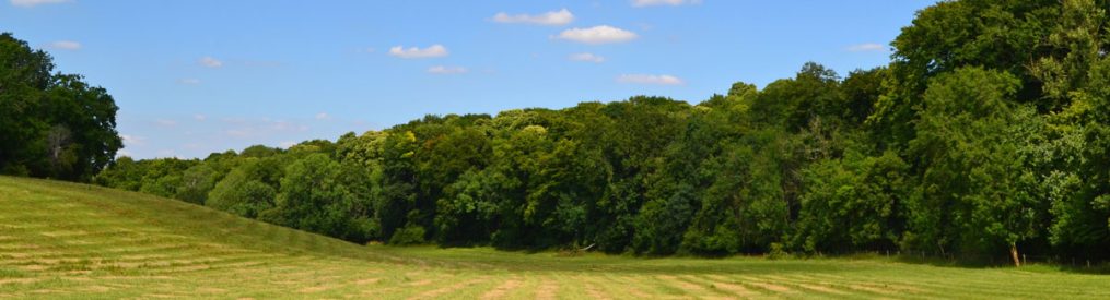
After a couple of hundred metres you reach a glade with a locally famous view over the Weald to the south. A seat offers a handy viewpoint, behind which is another lovely glade that in summer turns pink with rosebay willowherb. Here, you are right on top of the Greensand Ridge, the sandstone escarpment marking the edge of low weald which runs from Surrey (its highest point is Leith Hill) as far as Lympne in east Kent. Continue on the path eastward, keeping the sleep escarpment cliff on your immediate right. Soon you’ll make out an orchard ahead. Turn right as you reach it and cross a stile with the orchard and more open woodland now on your left and descend gradually in superb woodland.

View as you near point 4
This windy narrow path is among the most spectacular on all the walks of this site. The near vertical drop-off to the right draws the eye but take care with your footing. It’s all very muddy in winter this bit, but that’s life I guess. As the path descends, you’ll eventually come to an extraordinary tree – a beech – growing out of the side of the ridge, its roots reaching many yards along the surface before disappearing underground. Soon after this you descend steeply to Rooks Hill lane and Point 5.
Point 5-6 (850 metres) Turn right on Rooks Hill and walk a few metres downhill on the lane before resuming east on the footpath – signposted the Greensand Way, now narrow, on your left. The wild garlic here in spring is spectacular. The view to the south, initially across Rooks Hill Farm pasture, continues to be lovely.
After a few hundred metres and just after you pass the Ightham Mote estate sign the vegetation becomes particularly lush and the view up to the ridge above you – with its profusion of tangled trees – spectacular. A fantastically tall, straight oak tree is worth looking over at this point – quite rare for an oak I feel. Note the sandstone boulders and many butterflies on this stretch of the walk.
Butterflies do very well on this part of the route because of its south-facing, sheltered aspect. We have seen slow worms and lizards here too. There’s almost a tropical feel as the lie of the land often creates humid, windless conditions. Pass a sign stating you are now in the Ightham Mote NT estate, and continue. Note the Wilmot Hill path zigzagging down to meet you from the left. Then descend some steps to reach pretty Wilmot Cottage on your left.
Point 6-7 (900 metres) In front of Wilmot cottage leave the west-to-east path to Ightham Mote and take the path on the right heading downhill south. This southbound trail initially has more horsetail around it – a sure sign of more spring water close to the surface. Walk downhill passing through one line of trees and over another spring stream then on the edge of a field with hedgerows to the right of it. Sadly, the fields here don’t have much in the way of wildflower margin and can appear very barren, in contrast with the verdant countryside all around. Soon, reach Mote Road and a place called Budds or sometimes Budds Green, basically a couple of converted oasthouses, a larger house (set back to the right) and a kind of green, little more than a wide verge. This is Point 7.

Looking back up over horsetail plants from the downhill path to Budds
Point 7-8 (1.2km) Turn right here across the green and look for the path heading roughly west (on the right) by the near-side of the larger house. This path will take us all the way back to Underriver. Ignore the barking of the dogs from the house, if any; they are trained not to leave the garden so don’t worry. Walk past a pond or swamp and come out in a field.
Continue on this path straight, ignoring the farm track off to the left you soon come cross. Tractor tracks mark the path which is nearly dead straight. Again the fields here can appear very lifeless and barren. In the next field look for the yellow path marker up by the barns. It’s all nice and obvious. If there’s any livestock encountered (rare) you can divert easily enough if you want. You may glimpse the chimneys of grand 18th-century Underriver House up ahead.
Walk alongside a small wood (Ducks Grove) on the right and follow the path as it turns sharp right by yet another spring stream and you’ll go past a kind of lawn then comes out by some cottages. Follow the path to the left as it joins a lane serving attractive cottages (particularly the terrace). The path here joins a country road (Underriver House Road) at Point 8.
Point 8-9 (1km) Turn right (north west) up the lane then soon left (west) over a stile into fields. Follow the path through the field then over a stile into another field – note cricket pitch to the right. There are four or five small/medium fields to cross before you reach Underriver. You are heading west and can see Underriver ahead of you now anyway – you can’t get lost. You come out back on Carter’s Hill just north of the brilliant White Rock Inn (closed at the moment because of the Covid-19 crisis – fingers crossed it reopens soon or at all), with its excellent garden and lovely location. They’ve got boules there too. Voila.
Short version (3.5 miles, 1hr 20mins)
I like this route too (see GPX map here), it avoids mud being mostly on a stony track or lane and lops 40 minutes off I reckon – so still long enough to feel worthwhile but more tolerable if your children are playing up! The views are stlll good, but not as good, and you miss the drama of the ridge woods. Follow Points 1-4 as above. Then, at Point 4 take the track nearly opposite heading east and follow it for a mile or so as it bends south downhill to attractive converted oasthouses of Absalom Farm. After another couple of hundred metres the track joins Rooks Hill which quickly joins Underriver House Road. Head south-east down this road until you see a stile and footpath crossing fields on your right. This is Point 8 (see above). Follow this path through five smallish fields (note cricket ground on right in field two) back to Underriver.
Wildlife encounters on this walk: I get the feeling there’s a rich variety of birdlife here but it’s not easy to see. Of less oft-seen species I’ve seen yellowhammer, whinchat, buzzard, tawny owls, bullfinch and heard turtle dove heard “purring” in undergrowth at One Tree Hill – someone more expert than I (Dave for example, would see a lot more). Common lizard and slow worm seen too.
