The early stages of this walk, as of December 2022 are now spoiled by new fences. However, it still features wildflower meadows, Charles Darwin’s house, hedgerows, the chance of seeing second world war Spitfires, ancient woodland, beech trees and old, flint and wooden houses and a beautiful church with the graves of Darwin family members. Two pubs with decent food. Forty minutes’ drive from East Dulwich, bus from Bromley South or Hayes stations. Covered on Ordnance Survey Explorer 147 map. Use GPX map, (click on icon bottom left of map for real-time location). Not difficult navigation but GPX always handy if you have a smartphone, to use with the PDF print out. Combine with a visit to Darwin’s home Down House and/or the superb High Elms nature centre for a great day out. If you have time for another walk, try the Knockholt, Hosey Common or Polhill routes – each within five miles.
Distance from SE London: 35 min drive from Sydenham, 45 min from Bromley North on 146 bus
Getting there: public transport
146 bus from Bromley (20 mins’ duration), or train to Orpington and then R8 bus (15 mins, no Sunday service). You can also get the train to Hayes (on the Lewisham/Ladywell/Catford Bridge/Lower Sydenham line) and pick up the 146, or get a cab, or cycle. Hayes is the nearest railway station to Downe (about four miles away).
Parking is not always easy around Downe Village but usually I park near Christmas Tree Farm or just past North End Rd. Downe just is half an hour’s drive from Sydenham.
Download a pdf and print out this walk here
Click here to use GPX track at AllTrails
The walk (90 minutes/4 miles)
Route summary:
Point 1-2 (about 500m): Take the path right just east of Christmas Tree farm on Cudham Rd, passing over a stile (don’t inadvertently take the second path signed to Cudham). Walk south past Christmas Tree farm paddocks with new (as of December 2022) fence on your left. The path turns 90 degrees right, still with the new fence on your left, then it turns left (south) again to a corner of another pasture field. Follow this south with the fence still on your left until you hit a tarmaced driveway. Here turn left, towards a farmhouse.
Point 2-3 (480m): Head towards farmhouse (south east). Walk past sign for Stable Cottage and see ‘footpath’ sign in front of house pointing right (south). Join this path crossing over surfaced driveway and passing a monkey puzzle tree and follow edge of field heading south. Arrive at path junction.
Point 3-4 (550m): Turn left on this path (east) heading towards woods between hedgerows. Enter woods (ancient and very familiar to Charles Darwin) and follow path down hill until you hit Cudham Road. Turn right on this road for a few metres.
Point 4-5 (600m): Enter huge field in valley between Downe and Cudham and follow path south with woods on your right. Footpath coming up on right.
Point 5-6 (500m): Take footpath right (west) into beautiful woods (Blackbush and Twenty Shaw ancient woodland, managed by Woodland Trust) and climb fairly steeply up steps then enter an alley by gardens and hit Single St (the same road as Luxted Rd), cross the road and continue down alley opposite..
Point 6-7 (500m): On emerging from alley turn right on footpath on eastern edge of Downe/Biggin Hill Airport valley, now heading north. Soon you’ll hit Luxted Rd, this time on a corner. Look out for Bird House Lane (signed to activity centre or scout camp) on your left.
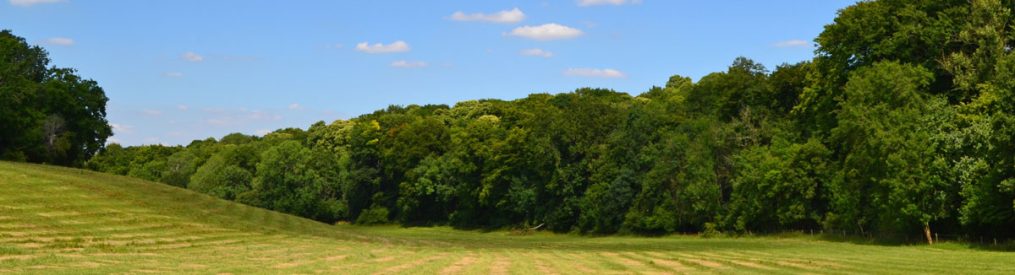
Point 7-8 (2.2km): Turn left on the road then left again downhill on a small lane (Bird House Lane) which serves a Scout camp nearer the airport. After a few metres watch for a footpath on your right just before a house and drive. Take this path (this is a long stretch now generally always heading north) skirting meadows and continue north along the eastern edge of the valley; go straight on at a path junction near Down House into light woods and soon cross West Hill. After this continue on the path heading north; it soon takes a 90-degree turn to the left and then right again to resume heading north. After this turn the path soon emerges into a large grassy hillside, the first of three fields with lovely views along the valley (with golf course on the left and tall beeches and the odd bomb crater to the right).
Point 8-Downe (500m): Enter woods after the third field and quickly turn right, looking for the footpath that goes east across the field back to Downe. Head for the south east (far right hand corner) of this field. The path narrows through a kind of alley and emerges on Rookery Rd nearly opposite North End Lane by a bus stop.

Donations
If you’ve enjoyed one of the walks on this site and feel it’s enriched your day, feel free to make a small donation here if you wish. It'll encourage me to add more walks, update information and work harder to improve accuracy and quality. Thanks a lot.
£3.00
More detailed route guide:
Get off the bus by the church of St Mary the Virgin (13th century; look out for the graves of Darwin’s family) and walk east past the George and Dragon pub on Cudham Rd. The walk starts with the marked footpath heading south off Cudham Rd just past the cute Christmas Tree Farm. This footpath is signposted to Biggin Hill and Luxted, and is by a brick wall – do not take the footpath signposted to Cudham a bit further on (another fine walk but not now!) (Point 1). Follow the fenced-in path (such a shame, the path beautifully traversed these meadows diagonally until December 2022 but now there are sheep in the fields and walkers are hemmed in on a path around the edges of the fields), with the enclosures of Christmas Tree farm on your right.
The fenced-in path (with Down House across the road to the right) soon reaches a tarmaced driveway leading to a farmhouse (Point 2). At the farmhouse, ignore another footpath sign pointing back towards Down House and continue past the Stable Cottage sign towards the house, skirting it and taking the path that heads south (right) just in front of it (another slightly hidden ‘footpath’ sign guides you) and go past a monkey puzzle tree while walking over a surfaced drive.
Follow the edge of a field to the left (east) then right (south). At Point 3 take the path heading east (left, heading away from Down House) at the intersection of footpaths heading towards woods between hedgerows.
The wonderful woods here are full of birdlife and bluebells (in late April). Walk downhill until you reach Cudham Rd. Here, turn right (Point 4) and very soon follow the signed footpath along a huge pasture with the woods now on your right. Above you, to the left you can see Cudham church and village on the ridge. If you fancy a (strenuous) detour there is a pleasant pub here with a fine beer garden (Blacksmith Arms).
Look for the path through ancient Woodland Trust-managed woods on your right – called Blackbush and Twenty Shaw (Point 5) – and climb up steps heading south west – there are no more uphill sections by the way after this. These woods are alive with many species including tawny owl, deer herds, badgers, orchids etc. The path soon becomes an alleyway and you hit Single St (actually a continuation of Luxted Rd) (point 6). Cross the road and continue west down another alley. When this emerges, turn right (north) and follow the path through a slightly tatty area of meadows, woodland and hedges. Lots of birdsong and glimpses of finches, thrushes, blackcap, even yellowhammer if you know what to look out for.
Soon you emerge on Luxted Rd, at a corner (point 7). Turn left then left again (west) down tiny Bird House Lane. Turn right (north) on a footpath just before a house and drive heading north again and continue all the way past a junction of paths behind the field to the rear of Darwin’s Sandwalk and garden (take a peep by walking up through the field – a beautiful place featured on Walk 1). The path is now in light woodland rather than along hedgerows.
Across your valley to your left, by the way, beyond more woods is the famous Biggin Hill airfield, one of the last remaining homes of The Few of Battle of Britain fame still operating as an airfield (more information below).
Soon you’ll reach West Hill, a small lane serving West Kent Golf Club down to your left. Cross and continue as the path turns sharp left then right again. Very soon now you’ll reach the first of the three hillside fields. You’ll see superb beech trees on your right (amid the occasional old bomb crater from one of many Luftwaffe attacks on the air base in August-September 1940) and the large golf club house across the valley to the left. Look out for deer, especially at dusk.
You’ll cross the three fields on this path before entering woodland and, after about 80 metres, turning 90-degrees right to enter a field (there used to be a stile here but it disappeared in 2017!) (Point 8) and head east across this oil seed/wheat/corn field aiming for the south-east corner (right-hand corner) until the path becomes narrow with a hedge on the right and you emerge back on to the village road. Until late March 2015 this field was a beautiful wild pasture with flowers and hawthorn trees. The tenant farmers have planted a cereal crop in there – lovely in June but muddy and annoying in winter. Also they have a nasty habit of ploughing it up and obliterating the footpath from time to time. On reaching the road (by a bus stop) turn right and look out for the Queen’s Head just before returning to the church and the village bus stop.
Biggin Hill Airport
The extensive woodland on the east side of the airfield, which this walk skirts, is that mentioned by the late Geoffrey Wellum in his astonishing book First Light, covering his time at RAF Biggin Hill as a 19-year-old Spitfire pilot. I cannot recommend the book enough… it’s not a tale of derring-do heroics but a very real record of an uncertain young man thrust into extraordinary circumstances. During the Battle of Britain the airfield was badly damaged by bombing after a burst of intense low and high level raids at the end of August 1940 – not as many lives were lost here as at Detling near Maidstone but there were over 40 military and civilian fatalities.
The airfield, whose history began with radio experiments before the First World War, played a key role in the Battle of Britain and until 1944 while home to an incredibly international wing of squadrons including legendary French pilots such as Rene Mouchotte and Pierre Closterman, New Zealander Al Deere and South African Sailor Malan. The stories surrounding this place are the stuff of legend and yet there is little to be seen that tells the stories of heroism and disaster concentrated in these few acres. The Aircraft Museum in Shoreham might be a good place to visit to get a feel for what happened here.
After the war, squadrons of Gloster Meteor jet fighters and Hawker Hunters were based at Biggin Hill until it was decided (in the mid 1950s) that the area was too built up and not suitable for fast jets – a decision made after a couple of fatal crashes in the vicinity.
Today the airport is used by flying clubs and executive jets. In recent years a few Spitfires, a Hurricane or two and assorted vintage aircraft have been based there and are often flown. One of the Spitfires, a second world war veteran that shot down a Luftwaffe fighter, was converted into a two-seater after the war and now takes passengers up – it’s about £2,750. The airfield has been a famous airshow venue ever since the 1920s – it is the site of the Red Arrows’ first display in the 1960s, and the first base for the Battle of Britain Memorial Flight (1950s). This tradition continues with often yearly airshows featuring the Red Arrows and extremely noisy jet fighters. You might find this thrilling; you might not.
Pubs and cafe
There’s a great little cake and tea shop, much used by weekend cyclists, on the left by the Rajdoot curry house just before the Queens Head. The Queen’s Head and the George and Dragon made the news on March 22, 2015 – ancient history now of course – when jolly protestors dressed as breastfeeding babies ambushed the UKIP leader Nigel Farage and rather spoiled his family’s Sunday lunch. What would Darwin have made of it all? Click the links for differing views of the protest, firstly from a Guardian journalist who travelled with the protestors and then the riposte from the Queen’s Head landlord. The Queen’s Head serves delicious ales from Westerham Brewery incidentally.
Pub guide on these walks click here
Another Downe walk
Great Kent walks, from John Harris’s Walking in England website


Pingback: Best north-west Kent bluebells of 2026 – the results are in – Kent walks near London
Pingback: A welcome rainy interlude – Kent walks near London
Fond memories of Cudham and surrounding countryside were I grew up. A big thanks to the passionate effort put into this website.
LikeLike
Pingback: Farnborough village and High Elms circular – Kent walks near London
Pingback: Grass and butterflies – Kent walks near London
Pingback: Best walks for orchids – Kent walks near London
Hi nice reading yyour blog
LikeLike
Pingback: Bluebells in north-west Kent: where’s best? – Kent walks near London
Pingback: My moment in the sun – Kent walks near London
Pingback: Find a walk that suits you – Kent walks near London
Pingback: All a flutter – Kent walks near London
Pingback: Bluebells on Kent walks: where is the cobalt carpet? – Kent walks near London
Pingback: Fears for tiers: Kent a no-go zone – Kent walks near London
Pingback: Bluebell fun facts – Kent walks near London
Pingback: Christmas and New Year’s walk choices – Kent walks near London
Pingback: The austere beauty of the Kent Downs in winter – Kent walks near London
Pingback: A longer Downe route – Kent walks near London