I love this route. It has atmosphere and much to excite the imagination: 2,000-plus years of visible human history; green sandstone geology; wildlife and flora in ancient woodland. This is a walk through mysterious – even spooky – woods around the site of a fort built in the first century BC by Celtic British tribes. And on the northern side of it there’s a great view of the North Downs escarpment. Later, the route passes a sandstone cliff, peaceful horse pasture and uses a sandy path through another quiet, atmospheric wood. It covers some of the same ground as Walk 22, serving as a short version of that stroll, sharing the same starting point: Styants Bottom Rd National Trust car park. Navigation is straightforward (the paths are mostly parallel to landmarks or roads) but it’s easy to lose confidence when you’re in thick woodland and faced with several paths, so use the OS GPX map on your smartphone to check your location as you go. Allow 1.5 hours for this walk, which is probably the most woody on this website.
How long from SE London? Car is best (50 mins from SE London) but I suppose you could catch a train to Borough Green (from Bromley South) or Sevenoaks Station (Thameslink or Charing Cross line via Grove Park) then taxi to Styants Bottom Rd (15 minute-ride) off the A25. There is a bus (the every 90-minutes 308 Sevenoaks to Gravesend service from Sevenoaks station and Borough Green station) that, according to Google maps, stops at Crown Point (now the Amherst Inn) very close to the start of the walk. It definitely stops near Ightham Mote (good for Walks 6, 7 and 22) and at Seal though (good for Walk 27 & 28).
Refreshments: The Amherst Inn is very close to the Styants Bottom Rd turning off the A25. Other options are a drive away, including Ightham Mote NT cafe. Otherwise head for Seal (a kebab house in a Tudor building!), Godden Green and Sevenoaks for pubs and cafes.
Start: Styants Bottom Rd NT car park off the A25, Seal Chart.
Download a pdf file of this route to print out or keep on phone
WALK DIRECTIONS
Click here for OS map and real-time GPX info (follow the arrow)
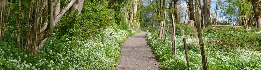
Point 1-2 2km Leave the car park and head across the road south east. Join path with ditch (part of the Iron Age ramparts) on your right, below you. Continue to walk by the ditch and follow the path as it nears the A25 then goes around the fort perimeter with the summit on your left. If you want to cut it a bit shorter, you can take a path on the left over the top of the fort and rejoin the circumference path to the north. After 1km or so you reach the northern part of the fort and can see across fields to the North Downs ridge, Heaverham, Kemsing and the St Clere Estate. Walk on the edge of the fields or on the parallel path in the woods. As you near Styants Farm House, the path descends between sandstone outcrops on a holloway.
Point 2-3 800m Head south on the road (Styants Bottom Rd again) then turn right as you reach Oldbury campsite on your right. The path takes you around the campsite, resuming its track south through woodlands. Continue towards the A25 which you will be able to hear soon.
Point 3-4 800m You should emerge from the woods on the A25 with a tarmac lane roughly opposite. The Amherst Inn should be in a dip to the left. Carefully cross and head down this lane passing a couple of houses and horsey pastures. Very pleasant little area this. Soon the lane becomes a path and heads up through woods. At a path T-junction at the top, turn left (or turn right to see lovely St Lawrence Church in its woody setting).
Point 4-5 800m Head south-east on this path (having turned left). Soon there will be warning signs about an unseen cliff on the right behind trees. This is a Greensand cliff (a kind of sandstone) set back from the main ridge, though converging on it behind Ightham Mote. After 800m at a slightly more open area note widely spaced ‘giant’ steps cut in a steep slope on the left. Descend them!
Point 5-end 1.1km After descending the steps at point 5 simply follow the sandy path north through lovely secluded feeling Fishpond woods. Eventually you’ll reach three marshy ponds on your left with fallen logs and giant water plants that look like something out of the Jurassic era. The path soon arrives back at the A25 nearly opposite Styants Bottom Rd and the car park. Good luck.

A log that looks like a prehistoric monster, between points 4 and 5 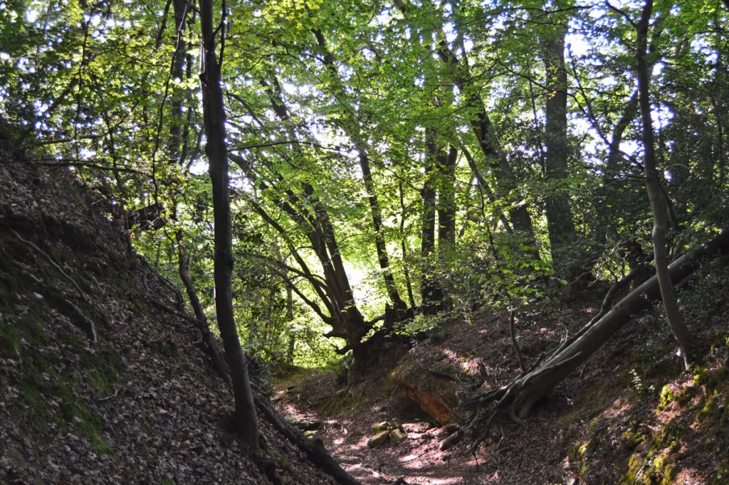
Holloway on north west slope of Oldbury Hill Fort 
Church, Stone Street, on Oldbury walk, July 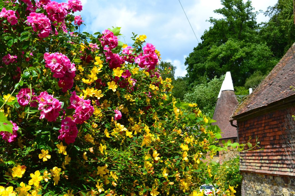
Oast house at the foot of the hillfort’s north-western corner at point 2 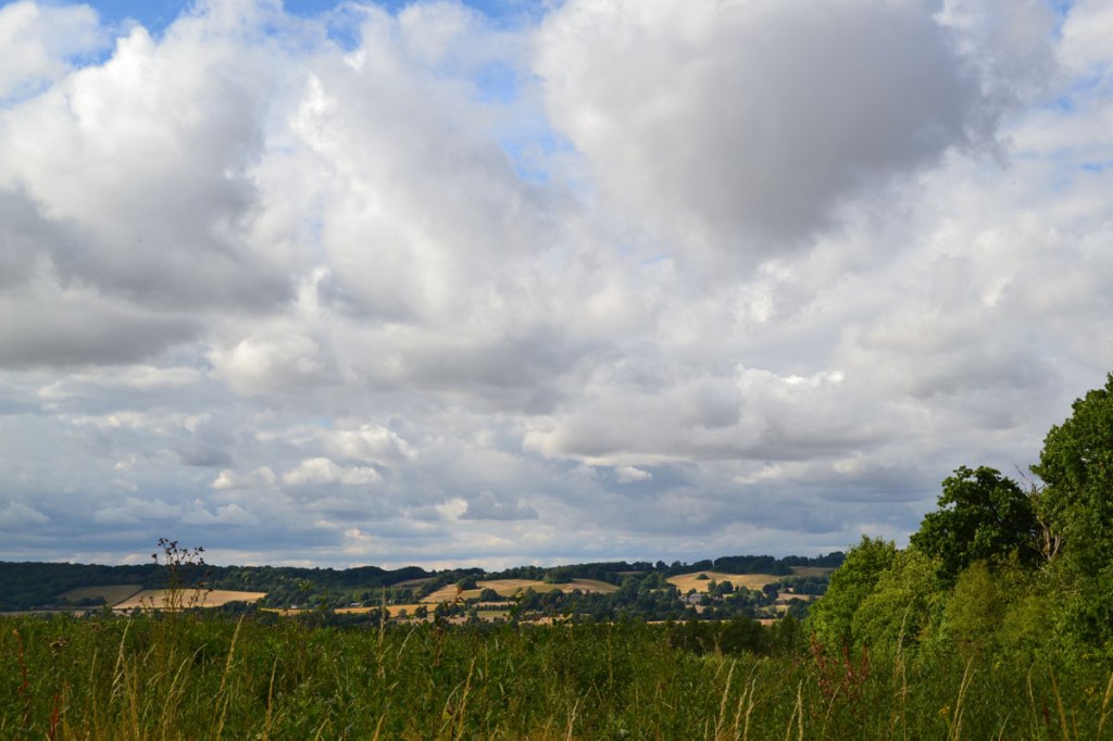
North Downs escarpment view from Oldbury hill fort – Kemsing and Heaverham 
Stunning pond just off the ‘sand path’ after point 5 and nearing the A25 at the end of the walk. One of three ponds. 
