Three classic cycle routes around Downe and Cudham

Cyclists from all over south-east London head off for the nearby North Downs lanes on weekday evenings and at weekends, often en masse as part of clubs. A lot of popular routes (like this one) leave from Crystal Palace/Elmers End and involve Westerham, Downe, Brasted and Cudham with some testing climbs, great scenery and relatively car-free lanes. You can do one of these routes on an old hybrid or mountain bike… you don’t need the latest road bike. There are hills, of course, though so a smidgeon of fitness is required. And although the lovely green lanes are nearly car-free at times, always bear in mind a Range Rover is about to come round the corner.

I’m partial to a good cycle too, along with various members of the fam, but we don’t think heading out on the busy ‘A’ roads is a lot of fun, so we plonk the bikes on a rack and drive to Downe or Cudham, park up, shed the bikes and off we go.

This slideshow requires JavaScript.

Here’s route one (Downe, Knockholt Cudham, Downe):
https://www.plotaroute.com/embedmap/432060

Route map for Downe/Cudham Cycle, 1 Hour by Adam McCulloch on plotaroute.com

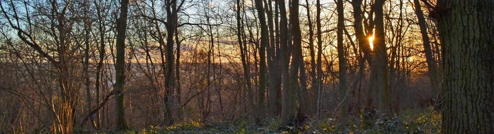
Go to menu (top right) and click on ‘hills’ to get a profile view of the route with terrain guide, gradients and heights above sea level. The second half of the route, after Hawley’s Corner, is remarkably traffic free but at all times, however quiet, you should anticipate a Range Rover swinging round the corner ahead of you. There are some fabulous downhill sections later in the ride (Shelley’s Lane, Knockholt and Downe Rd on leaving Cudham) where really high speeds can be built up quickly but please just imagine a car pulling out (there’s one or two driveways) or coming round a corner quickly. The final (steep) hill, back up to Downe village (Cudham Rd), is through Downe Bank, one of Charles Darwin’s research zones. Some massive history right there in those woods.

Here’s a link to a topographic view of the route; there’re more uphills than down but don’t be misled; most of the uphills are gentle whereas the downhills are sharper.

This slideshow requires JavaScript.

Route 2 (via Chevening): Downe, Horns Green, Chevening hamlet, Knockholt, Cudham, Downe
https://www.plotaroute.com/embedmap/432067

Route map for Downe/Chevening/Cudham by Adam McCulloch on plotaroute.com

This one’s a bit longer at 16 miles (say 90 mins) and adds in one gorgeous downhill (Brasted Hill) and one strenuous uphill section (Starhill Rd). The route is easy to extend to Brasted and Ide Hill, even Hever, if you like, but those roads tend to be a bit busier. On the map it looks as if you have to double back at Chevening but in fact you can take your bike on a footpath behind the church to join the road and crack on up Starhill Rd. Oh yes, Chevening House is where Boris Johnson, Liam Fox and David Davis periodically hang out. The church and houses there are very nice though. A third Downe variation, taking in the very quiet but taxing Sundridge Hill (rather than the busier Starhill Rd) is here:https://www.plotaroute.com/embedmap/447637

This slideshow requires JavaScript.

Route map for Downe/Knockholt Pound/Cudham by Adam McCulloch on plotaroute.com

Route 3: (Downe, Knockholt, New Years Lane, Cudham, Downe). This third route is very quiet traffic-wise and, at 14 miles, is a good little work out with a couple of steep hills. A nice road to cycle down is Blueberry Lane just before Knockholt Pound.

If you don’t fancy parking on the street at Downe (sometimes awkward) there is the car park at High Elms country park a mile to the north and the car park at Cudham recreation ground. Or just cycle all the way from Peckham/Lewisham or wherever. Or get the train to Orpington or Hayes and cycle from there. Take care on the busy roads though.

Emmetts Garden and the Ide Hill walk colours

I love to do this walk several times over the spring, catching the various colours as they flare up and die down at Emmetts and in the woods and fields. The bluebell clouds are starting to fade now; by next weekend they’ll be well past their best (although the wild garlic is still vibrant), but soon the foxglove ‘forests’ of the Ide Hill/Toys Hill valley will spire up to replace them. I wonder if the bluebells have been a bit short-lived this year because of the cold, dry weather, which followed a very warm early spring. Meanwhile, the browns of early spring have been replaced by shades of vivid green. Emmetts of course is always a kaleidoscope of colour and right now is peak azalea. And those tulips… weird and so photogenic. This year’s black, red and white scheme is the best I’ve seen – check out the pictures below. Here are a few pix from the past two years in Emmetts and on the Ide Hill walk.

This slideshow requires JavaScript.


Beckenham Place Park – great for a local stroll

Sadly for us south-east London golfers the 18-hole Beckenham course – once the UK’s busiest – has gone; happily for us south-east London walkers the space now opened up is superb! There are expansive grass areas, a mildly hilly terrain, footpaths through woods adorned with bluebells just now, plus excellent birdwatching and a no-nonsense cafe in the striking, though decaying, 18th-century mansion (where there are also yoga classes and an artist’s studio). If you can’t make it out to the countryside or to Chislehurst/Petts Wood, the park is a great place to get some exercise locally: it’s possible to do a three-mile walk within and around it.

Beckenham Place Park mansion

Beckenham Place Park mansion

Access

You can enter it from opposite Ravensbourne Station or from several points on Beckenham Hill Rd and from Westgate Rd. If you get off the train at Beckenham Junction or New Beckenham, just walk up to Foxgrove Rd and take the lane off to the left with rather grandiose houses on it called Beckenham Place Park. It’s also a short walk from Beckenham Hill station on the Thameslink (like Ravensbourne).

This slideshow requires JavaScript.

Development

There are no plans to build on the park yet thankfully – but maximum vigilance is urged on that score. The only development at present will be flood defences (the Ravensbourne, Quaggy, Pool and Honor Oak rivers have been known to flood houses in the past), so bore holes and the creation of a water meadow kind of thing are on the cards. There has also been a lot of tree planting (native species).
The Friends of Beckenham Place Park website provides more details on events, development plans and amenities in the park. It’s possible to do a good urban walk linking Beckenham Place with the excellent Kelsey Park and South Norwood Country Park without too much pavement stomping. Oh, and there are kingfishers regularly seen on the Ravensbourne river.

Castle Inn now open at Chiddingstone

The Tudor hamlet of Chiddingstone now boasts a superb pub once again. The Castle Inn (website is a work in progress apparently) reopened a few days ago (6 April 2016) in a 500-year-old building with original beams. It has two smallish bars, a couple of nice lounges and dining areas and a cute beer garden. The local brew, Larkins, is a real winner and the bar staff are friendly and amenable. There’s a large open kitchen and though I didn’t eat there, you kind of feel the food’s going to be pretty good. Recommended for any walkers on the Chiddingstone walk (at the start/end of walk) and Hever walk (short diversion from Hill Hoath).

The Castle Inn, Chiddingstone

The Castle Inn, a beautiful pub in a Tudor building next to Chiddingstone Castle


Bluebells around Shoreham, Ide Hill, Downe, Chislehurst, Kent

It’s that astonishing time of year when woods turn blue. I think from Easter to early May the bluebells will be great – there are some patches already in full bloom. The best of my walks for bluebells are Ide Hill and One Tree Hill (see below). Read 2020 bluebell piece here

Bluebells on the Ide Hill walk, April 25, 2015

Bluebells on the Ide Hill walk

Here are the best places on my walks:

  • Shoreham circular: take the high path through Meenfield woods, the one that goes along the top of the hill. It’s marked on my digital map with a blue line. It just means continuing to the top of the hill after point 7 and turning right (north) at the top rather than two-thirds of the way up. The parallel paths meet later, by Shacklands Rd. There are not many bluebells on the regular route, so as I say, take the high Meenfield woods path.
  • Ide Hill: the best walk for continuous bluebells. There are great bluebells straightaway once you enter the Ide Hill NT woods behind the church, and even better in Scords wood just below Emmetts Garden. (Picture.) Amazing bluebells at Emmetts of course, but it’s best to pay the fee (or at least buy some cake!) if you linger in the gardens.
  • One Tree Hill walks: Good bluebells throughout these NT woods and also at the top of Wilmots Hill (on the ‘figure of eight‘ walk). Some lovely pockets of mixed bluebells and wild garlic (picture) off to the side of the path as you near Ightam Mote too (including a kind of garlic ‘jungle’ at one point). Some in the woodland between Shipbourne and Underriver too.
  • Downe: like the Shoreham circular you just have to make a small diversion to get the best bluebells, which are to be found in the hillside woods between Downe and Cudham (picture). Just turn left instead of right at point 3 and walk down to the woods. The hillside is called Downe Bank – a favourite place of study for Charles Darwin and John Lubbock (these great scientists’ names still make infuse this area with greatness and give it a special atmosphere). There aren’t many bluebells to be seen without the diversion.
  • There are good stretches of the blue stuff on the Hever walk, but perhaps less so on the Chiddingstone walk except in the woods above the river Eden (picture) on the return leg of the walk. There are excellent areas of the flowers on the Chislehurst/Petts Wood walk in the lower part of the wood, amid the chestnut groves just east of point 7 close to the railway tracks, stretching north towards the central fields. Knole Park is not great for bluebells compared with the other walks – but then One Tree Hill is just round the corner to sate your blues. However, back to Shoreham, the two Romney St/Shoreham eastern valley walks (5 and 14) have fantastic patches of bluebells in most of the woods the paths pass through.

Find a north-west Kent walk that suits you


Here’s a map of all the walks on this site so far. Click on the pointers to take you to descriptions of the walks online or in printable pdf format. Alternatively, use the walk tabs at the top of this page.

The best walks on this site for public transport, if you live in SE London are:

Best for public transport: Chislehurst/Petts Wood walk (13): direct train to Chislehurst/Petts Wood/Bickley stations from Brixton/Hither Green/Catford/Herne Hill/West Dulwich/Peckham Rye/Nunhead. For the Shoreham/Eynsford and Otford routes (walks 2, 3, 5, 8, 12, 14, 16) there are trains direct to the starts of the walks on Thameslink services between London Blackfriars and Sevenoaks (stopping at Peckham Rye, Nunhead, Catford, Bellingham, Bromley South etc). Trains are relatively frequent and take about 30 minutes from, say, Catford to Otford. Pubs in Shoreham and Eynsford well placed for any delays or cancellations!
So-so for transport: Downe (walk 1): closest route to SE London but involves a (fairly frequent) 25-min bus ride – 146 from Bromley South station
OK for transport: Knole Park (walk 11) – you’ll have to walk from Sevenoaks station (good rail services to Sevenoaks station on Thameslink – see above – or Charing Cross line (Hither Green etc) for nearly a mile to the leisure centre and enter Knole from there, joining the walk as per instructions and map.
Bit of a stretch but do-able: Hever (walk 9) actually has a station, on the London Bridge line via East Croydon, so quite easy from Forest Hill, Brockley etc if you plan ahead. The walk starts at Hever Castle, 1 mile from the station but there’s a path that will take you there from the station.
Not so accessible: Sevenoaks routes (walks 4, 6, 7): can take train to Sevenoaks station on Thameslink or Charing Cross line (Hither Green etc), but then a taxi ride – Ide Hill is about 4 miles from the station; One Tree Hill about 3 miles (also quite close to Hildenborough station).
Car only, although…: I think Chiddingstone is definitely best by car. But, you can take the train to Hildenborough or Edenbridge and get a taxi (more details on walk’s page). Westerham/Chartwell is best with a car, though again bus from Bromley is possible (246), as is taxi from Sevenoaks station.

Always check ‘live departures’ online for trains – service disruption is quite the thing these days you know.

Best for views

One Tree Hill, Ide Hill, Otford circular via Romney St, Fackenden Down, Westerham/Chartwell, Shoreham’s mystery eastern valleys, Polhill, Eynsford/Lullingstone. Oh… actually all of ’em.

Best pubs on the walks – click here

See menu at top of page for full list of walks

Which of these walks are best for public transport links?


Here’s a map of all the walks on this site so far. Click on the pointers to take you to descriptions of the walks online or in printable pdf format. Alternatively, use the walk tabs at the top of this page. No one likes standing for ages at bus stops or on railway platforms but I will say the bus to Downe is relatively reliable and frequent and the train to Eynsford, Shoreham and Otford is pretty good too (and there are pubs to dip in to if you have to wait for ages anyway) – although watch out for engineering work on Sundays. More details below. Tell me if you have any tips I’ve left out.

The best walks on this site for public transport, if you live in SE London are:

Best for public transport: Chislehurst/Petts Wood walk (13): direct train to Chislehurst/Petts Wood/Bickley stations from Brixton/Hither Green/Catford/Herne Hill/West Dulwich/Peckham Rye/Nunhead. For the Shoreham/Eynsford and Otford routes (walks 2, 3, 5, 8, 12, 14) there are trains direct to the starts of the walks on Thameslink services between London Blackfriars and Sevenoaks (stopping at Peckham Rye, Nunhead, Catford, Bellingham, Bromley South etc). Trains are relatively frequent and take about 30 minutes from, say, Catford to Otford. Pubs in Shoreham and Eynsford well placed for any delays or cancellations!
So-so for transport: Downe (walk 1): closest route to SE London but involves a (fairly frequent) 25-min bus ride – 146 from Bromley South station
OK for transport: Knole Park (walk 11) – you’ll have to walk from Sevenoaks station (good rail services to Sevenoaks station on Thameslink – see above – or Charing Cross line (Hither Green etc) for nearly a mile to the leisure centre and enter Knole from there, joining the walk as per instructions and map.
Bit of a stretch but do-able: Hever (walk 9) actually has a station, on the London Bridge line via East Croydon, so quite easy from Forest Hill, Brockley etc if you plan ahead. The walk starts at Hever Castle, 1 mile from the station but there’s a path that will take you there from the station.
Not so accessible: Sevenoaks routes (walks 4, 6, 7): can take train to Sevenoaks station on Thameslink or Charing Cross line (Hither Green etc), but then a taxi ride – Ide Hill is about 4 miles from the station; One Tree Hill about 3 miles (also quite close to Hildenborough station).
Car only, although…: I think Chiddingstone is definitely best by car. But, you can take the train to Hildenborough or Edenbridge and get a taxi (more details on walk’s page).

My walks

• Download Walk 1Downe circular (near Bromley, 2.6 miles) View on your phone/PC
• Download Walk 2Shoreham circular (3.5 miles) View
• Download Walk 3Shoreham to Eynsford (4.2 miles) View
• Download Walk 4Ide Hill circular (3 miles) View
• Download Walk 5Otford circular via Romney St (5.5 miles) View
• Download Walk 6One Tree Hill circular (near Sevenoaks, 5.5 miles) View
• Download Walk 7One Tree Hill figure of eight (near Sevenoaks, 5 miles) View
• Download Walk 8Shoreham/Otford circular (5 miles) View
• Download Walk 9Hever circular (4.5 miles) View
 Download Walk 10: Chiddingstone/Penshurst circular (4 miles) View
• Download Walk 11: Knole Park’s Wild Side (3.5 miles) View
 Download Walk 12: Eynsford/Lullingstone circular (4 miles) View
 Download Walk 13: Chislehurst station to Petts Wood station (3.7 miles) View
• Download Walk 14: Shorehams mystery eastern valleys (4.5 miles) View

Spring in the air?

Two weeks ago I walked at Downe in snow (see pictures below) – a reminder that villages near the leading edge of the North Downs (Ide Hill is another) are just enough metres higher than SE London to convert rain into snow. Since then there have been signs of spring; no sightings of ridiculously early bluebells so far, unlike this time last year, but a milder feel despite Doris rushing through. This past weekend a drizzly Knole Park walk was hugely enjoyable. Although the park was surprisingly busy there was a lovely wild atmosphere about the place and the removal of scaffolding from the side of Knole House restores the Tudor integrity of that fantastic structure. Busy green woodpeckers and flitting small mixed groups of finches provided the evidence that change is in the air. No owls though, even as dusk came on.

Downe in winter snow

Awful weather this week – overcast, cold – but at least there was some snow today to enliven proceedings. I decided to get some fresh air on the Downe walk. In south-east London the snowfall didn’t stick whatsoever but by the time I reached Keston there were extensive patches. Below are some iPhone images of the Downe circular walk taken sequentially. I nipped off-piste down to the golf course after point 5 – the unblemished snow on the fairway made me feel as if I were walking on goose feathers; the powder had a strangely translucent appearance I’d never seen in snow before. Popped into the Queen’s Head where a half of Westerham Ales’ Grasshopper by the fire, with Italy v Ireland rugby on the telly, was a splendid ‘warm down’. Once again, a rotten day for weather comes up trumps (whoops, sorry, banned word there).

This slideshow requires JavaScript.


New walk: Shoreham’s mystery eastern valleys

Beyond the steep, thickly wooded eastern wall of the Darent Valley is a quiet chalk upland area of dry valleys, meadows and plateaus. There’s a disused golf course, now overgrown and becoming a bit of an unofficial wildlife reserve, lovely north-south views, a discreet private airstrip behind a strip of woods from which vintage light aircraft are regularly flown, and, well… that’s it really. It’s a very atmospheric area and, for me, quite different in nature from the western valley wall. My new, ‘eastern valleys’ walk (number 14, 4.5 miles, pix below) really digs into this tranquil, timeless landscape via the little hamlet close to the defunct Austin Lodge clubhouse. Also the Otford/Shoreham/Romney St walk (5) takes in some of it. Walkers can combine the two routes to make a 10-miler or combine them with the Shoreham Circular strolls (8.5 miles). The starting point for the new walk is Shoreham railway station, which is well connected to south-east London, by Thameslink trains (not the most reliable line but so handy for the countryside). It can also be started from the church with an alternative route up to the plateau. There are some steep sections so you’ll feel this one afterwards. Enjoy. (Download a pdf of this walk.)

This slideshow requires JavaScript.