I’ve added two new circular walks, a bit further than the others from south-east London, at Hever (walk 9) and a few miles to the east, Chiddingstone/Penshurst (walk 10). They are both possible on public transport from south London: trains from East Croydon run to Hever and Penshurst, but unfortunately neither station is en route; being 1.5 miles from the start in the case of Hever and two miles from the walk for Chiddingstone/Penshurst. Both are lovely and quiet; Hever has more woods and sandstone outcrop, whereas Chidd/Pens is more meadowy and crosses the river Eden twice. Each has a small section on roads where you have to be careful. The bit on the road at Penshurst on the Chiddingstone walk is particularly bad so don’t do it with younger kids. Both walks use the Eden Valley Path for the first half. Hever, Chiddingstone and Penshurst are all Tudor villages with great houses linked with Henry VIII, the Boleyns and others so these walks, or parts of, are particularly good for youngsters studying that period at school. Both have great pubs: the Henry VIII at Hever and the Castle Inn at Chiddingstone.
Here’s a reminder of the historical connections of the walks on this site and a map of their locations.
• Penshurst Place (nr Tonbridge) Tudor home (many scenes from Wolf Hall were shot here) with great adventure playground and superb gardens. On Chiddingstone circular
• High Elms nature reserve (nr Bromley): excellent nature centre with orchards, ponds, cafe, wildlife information plus gardens (free). Close to Downe circular
• Hever Castle (nr Edenbridge), quite expensive but a great day out. Anne Boleyn’s childhood home. Often a bit crowded. Hever circular starts here
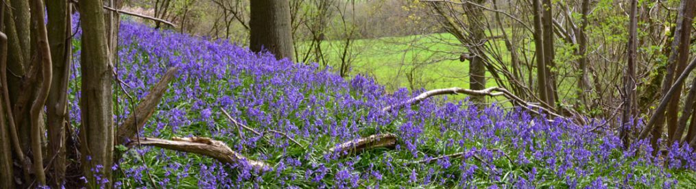
• Emmett’s Gardens: (nr Ide Hill/Brasted) great gardens for azaleas, tulips, bluebells with south facing escarpment, lovely view. Lubbock family connection. On the Ide Hill circular
• Knole: (Sevenoaks) super Tudor pile, but public not allowed in gardens (boo). Knole Park brilliant for walking though and close to One Tree Hill walks on this site
• Lullingstone Country Park (Eynsford): on the Shoreham to Eynsford walk; a great area for strolling. Tudor gatehouse to much altered castle
• Down House (Downe/Bromley): Charles Darwin’s house always fascinates with interesting gardens. On the Downe circular walk
And here are those walks again. They work for me at all times but in the spring I’ve always favoured the Otford circular via Romney St and the Ide Hill walks for some reason.
• Download Walk 1: Downe circular (near Bromley, 2.6 miles) View on your phone/PC
• Download Walk 2: Shoreham circular (3.5 miles) View
• Download Walk 3: Shoreham to Eynsford (4.2 miles) View
• Download Walk 4: Ide Hill circular (3 miles) View
• Download Walk 5: Otford circular via Romney St (5.5 miles) View
• Download Walk 6: One Tree Hill circular (near Sevenoaks, 5.5 miles) View
• Download Walk 7: One Tree Hill figure of eight (near Sevenoaks, 5 miles) View
• Download Walk 8: Shoreham/Otford circular (5 miles) View
• Download Walk 9: Hever circular (4.5 miles) View
• Download Walk 10: Chiddingstone/Penshurst circular (4 miles) View
• Download Walk 11: Knole Park’s Wild Side (3.5 miles) View
• Download Walk 12: Eynsford/Lullingstone circular (4 miles) View
• Download Walk 13: Chislehurst station to Petts Wood station (3.7 miles) View
• Download Walk 14: Shoreham’s mystery eastern valleys (4.5 miles) View


