The heat is on – escape from SE London?

The heat is on – escape from SE London?

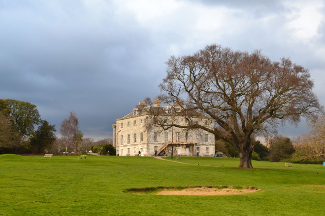
For many of us, the coming heatwave will be a bit OTT what with not being particularly near a beach and with so little access to open-air pools in London – unless you are lucky enough to live close to one. There was a time when we were much better served with lidos but – rather like the railway cuts 60 years ago – short-term profit for a few was allowed to triumph over health and environmental benefits for the many in the early 1980s. The result is that the queue for places like Brockwell Park Lido is usually pretty mega in hot weather. Crap isn’t it? But there it is. Compare with Germany where every city seems to provide fantastic open water swimming spaces. Beckenham to the rescue. The pleasant lake there offers £5.80 tickets for an hour long swim and it looks as if slots are still available this week. (Pictured below: the woods on the Cudham and Downe walks offer respite from the heat)

Anyway, I’ve noticed my old blog post on Bough Beech reservoir getting a lot of hits. This is probably because people are dreaming of having a swim. Forget it. It’s not possible there I’m afraid and strictly forbidden – it’s a nature reserve and an important facility, so it’s definitely a no-go zone. I’ve noticed people taking to local rivers; the River Pool, the Darent, the Medway, the Eden and the Cray, in certain places. I wouldn’t recommend it: there are just too many issues, including pollution, dangerous substances in the water etc, and although I know a few places where I might take a dip it would be irresponsible to recommend them to others (he said, pompously). OK, OK, OK … cycle or walk from Tonbridge Castle to Penshurst Place on the Hayden country park path; there’s a lovely spot a mile short of Penshurst for a dip in the Medway. But you won’t be alone!

Summer evening sky, early July

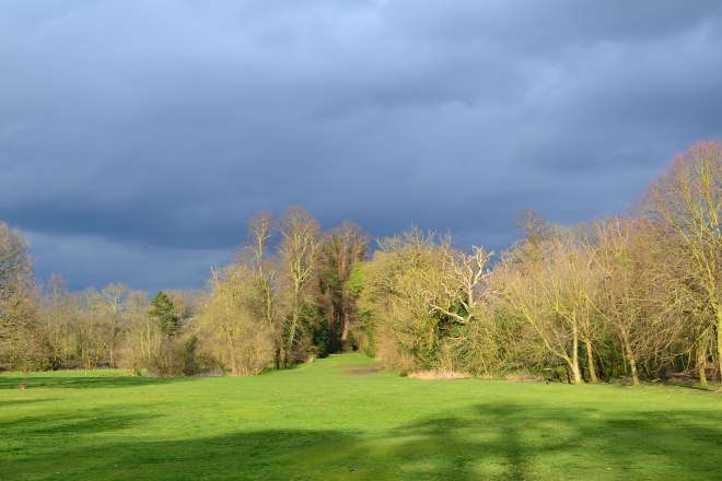
The beach is the best option along with dedicated sites such as Leybourne Lakes just west of Maidstone, and the previously mentioned Beckenham Place Park. But other than swimming, woodland walks are great for getting exercise while staying cooler at this time of year: Petts Wood, the Meenfield woods routes near Shoreham, the Hever walk and Hosey Common are the best for shade, along with walks within Bromley borough (but not yet on this site) at High Elms and Hayes Common towards Downe. Yesterday on the superb, understated Cudham walk, just as we began to feel the power of the sunshine we would enter the cool woods and comfort levels shot up. Take water obvs. It was on 10 July that the Battle of Britain started, so a good day to hear the distant murmur of Merlin engines as the Biggin Hill Spitfires headed out on their joyriding sorties.

Advertisement
Downe Downe deeper Downe

Downe Downe deeper Downe

I’ve always liked that Status Quo song ever since I was a young teenager. I’m no headbanger but it’s got energy and drive – which Kent walkers have in abundance of course.

GPX dodgy and iffy instructions

I did both Downe walks this weekend. The weather was distinctly iffy so I couldn’t be bothered to go far. So I did the new longer Downe walk on Saturday and the usual shorter one on Sunday with my wife. She was not too impressed by my instructions; “too wordy” she said in a slightly irritated fashion after about 50 yards. My attention was somewhat distracted by a B-17 Flying Fortress flying low overhead, but then she pointed out I had omitted to mention any stiles and gates and thought my ‘line of trees’ was really a wood. It made me realise that we all see things a bit differently and that I’m so familiar with the walk that I was imagining rather than actually seeing. That’s quite a phenomenon – try describing your walk to the station or to the office… it’s so obvious to you but you suddenly realise that you’ve completely misdescribed a house or a shop.

Compounding the unclear directions is the uncomfortable fact that the GPX tracks I’m pointing people to on the website are distinctly dodgy. On Saturday it was only right 50% of the time; often the blue dot marking your ‘live’ location would linger unhappily in a nearby road or layby. No idea why. Could be a signal thing or a sign you are running out of data, a position I’m very familiar with. Today, on the short Downe walk, the GPX was inaccurate the whole time. I’ll have to redo the track, maybe using a different website but then there might just be something about Downe, deeper Downe.

Here’s the pdf for the new instructions for Walk 1 Downe Circular. Gratitude to my wife for opening my eyes and apologies to anyone I’ve misled. And here is, hopefully, a more reliable GPX track.

By the way, I’ve learnt a new wildflower name and I’m going to use it. Birds-foot-trefoil. It’s small and yellow and spectacular at Downe, particularly in the meadows close to Darwin’s house (of course!). Apparently the plant is a staple in the diet of caterpillars of common blue, silver-studded blue and wood white butterflies. There are also pyramidal orchids at the moment in the the hillside fields that end the walk.

Hillside field point 7-8, Downe

The austere beauty of the Kent Downs in winter

Winter has arrived but it remains mild; with more rainfall the mud has churned up on the most of the walks so it’s time for wellies. But take care: the chalky Darent Valley hillside paths can be a bit slippery at this time of year, particularly where the paths are worn and the chalk is close to the surface. But the austere beauty of the North Downs in winter is now evident, especially on the eastern side of the valley – walks 5, 14 and 19 – and on the Eynsford routes: walks 3 and 12. If the temperature drops a bit take a flask out with some hot chocolate and maybe a shot of something stronger – really works out here in an easterly wind!

Each of the walks on this site have their own character. There’s definitely a split between the southern routes, such as Chiddingstone, Ide Hill and at Hever, which are more wooded and somehow bucolic, and the more hilly, more grassy northern routes of the Darent Valley where the ridgelines are the highest points for an easterly winds for hundreds of miles. It’s all very atmospheric; when walking I often imagine what life was like for Saxons, Romans, Britons and Vikings who settled these parts and picture them on their long, painstaking journeys.

So, here’s a useful way of choosing a walk near SE London … enlarge the map, then just click on the labels and lines to find a walk that suits you. You’ll see there’s quite a spaghetti junction of walks around Shoreham, you can combine them all and stay out all week if you like! My tip this week is Walk 19: Fackenden Down. It’s on the eastern side of the Darent Valley – straight out of Shoreham train station and the views are terrific. The walks are also on the menu at the top. Enjoy…

My walks

Download Walk 1: Downe circular (near Bromley, 2.6 miles) View on your phone/desktop
Download Walk 2: Shoreham circular (3.5 miles) View
Download Walk 3: Shoreham to Eynsford (4.2 miles) View

Download Walk 4: Ide Hill circular (3 miles) View
Download Walk 5: Otford circular via Romney St (5.5 miles) View

Download Walk 6: One Tree Hill circular (near Sevenoaks, 5.5 miles) View
Download Walk 7: One Tree Hill figure of eight (near Sevenoaks, 5 miles) View
Download Walk 8: Shoreham/Otford circular (5 miles) View
Download Walk 9: Hever circular (4.5 miles) View
 Download Walk 10: Chiddingstone/Penshurst circular (4 miles) View
Download Walk 11: Knole Park’s Wild Side (3.5 miles) View
 Download Walk 12: Eynsford/Lullingstone circular (4 miles) View
 Download Walk 13: Chislehurst station to Petts Wood station (3.7 miles) View
Download Walk 14: Shorehams mystery eastern valleys (5 miles) View
Download Walk 15: Westerham/Chartwell (5.5 miles)
View
Download Walk 16: Shoreham circular mk2 (3.5 miles) View
• Download Walk 17: Bough Beech/Bore Place (2.5 miles) View
Download Walk 18: Shoreham/Polhill Bank (4 miles) View
Downland Walk 19: Fackenden Down (4 miles) View
Download Walk 20: Downe circular mk2 (4 miles) View

An online version of the Ordnance Survey map 147 can be found here but strangely some public footpaths are not included. I’m gradually working on making GPX files for the walks so they can be followed ‘live’ on smartphone, but, ahem, slow progress is being made!

Biggin Hill Airshow weekend

A more subdued airshow than last year’s fast jet bonanza but with some wonderful flying. During our weekly Downe-Knockholt-Pilgrims Way cycle we enjoyed the sight and sound of Spitfires, Blenheim, Sea Fury and Hurricanes, and arrived at the airfield via Tatsfield just in time for the Red Arrows, the Flying Fortress and the fantastic Spitfire solo aerobatic display flown by Dan Griffiths. This brought to mind the great Spitfire displays of the legendary Ray Hanna in times past. Downe walk download here.

Red Arrows split

Red Arrows peel off to land

Darwin’s fields and Downe

My favourite of all the wonderful meadows on these walks is the one adjacent to Darwin’s house at Downe. In August the grass is yellowing and long; it shines in the sun and bends, waving with the breeze. The thought of the scientist wandering these paths, perhaps with his wife and children, pondering some quirk of fauna and flora makes it all the more atmospheric.

After passing through this field, you cross Darwin’s ‘sandwalk’ and a hillside meadow with views across woods with no sign of human habitation in sight. Deer gather in this field at dusk and it’s a good place to spot birds in the surrounding beeches. For some reason green woodpeckers are often seen on the ground here. A tranquil, timeless place, but deceptive: there’s Biggin Hill airport (the former Battle of Britain base and now a major heritage and business aviation centre) just on the other side of the woods, and beyond that the eponymous town.

I’ve added a link to a GPX map now too, where you can check your progress on the Downe walk in real time – if you can get a network connection.

This slideshow requires JavaScript.

A stroll closer to home…

If the abysmal weather puts you off travelling out of town for a walk, but the local park bores you rigid, I suggest Beckenham Place Park and Petts Wood for a stroll this Easter. Plenty of great woodland, only a few minutes’ drive from Forest Hill/Lewisham; a great chance for some fresh-ish air close at hand. Beckenham has a good cafe in the mansion; Petts Wood (a bit further out) has ample pubs dotted around it. Below are two pictures from yesterday late afternoon in Beckenham.

Beckenham Place Park mansion

Beckenham Place Park mansion with a bunker from the rapidly disappearing old golf course

Beckenham Place Park

Sunshine at last … A view down a former golf fairway at Beckenham Place Park

Downe walk

The Downe walk is very handy when you haven’t got much time (and you have a car) because it’s relatively close to SE London. It’s also great to do after/before visiting Downe House and has two good pubs, a lovely cake shop and a pretty good curry house. It’s also quite short (2.5 miles) – enough for a bit of exercise without risking pulling a hamstring. One thing I’ve noticed of late is that whoever farms the final field on re-entering the village keeps obliterating the footpath every time they harvest/plough. It’s quite annoying and thoughtless. There are enough walkers to re-establish the path but after it rains that final field won’t be a lot of fun. I can’t really suggest a diversion either. Anyway, with autumn colours it’s all looking rather nice … (pictured is the penultimate field, not the ploughed up one).

Autumn colours on the Downe walk

Autumn colours on the Downe walk

Beckenham Place Park – great for a local stroll

Sadly for us south-east London golfers the 18-hole Beckenham course – once the UK’s busiest – has gone; happily for us south-east London walkers the space now opened up is superb! There are expansive grass areas, a mildly hilly terrain, footpaths through woods adorned with bluebells just now, plus excellent birdwatching and a no-nonsense cafe in the striking, though decaying, 18th-century mansion (where there are also yoga classes and an artist’s studio). If you can’t make it out to the countryside or to Chislehurst/Petts Wood, the park is a great place to get some exercise locally: it’s possible to do a three-mile walk within and around it.

Beckenham Place Park mansion

Beckenham Place Park mansion

Access

You can enter it from opposite Ravensbourne Station or from several points on Beckenham Hill Rd and from Westgate Rd. If you get off the train at Beckenham Junction or New Beckenham, just walk up to Foxgrove Rd and take the lane off to the left with rather grandiose houses on it called Beckenham Place Park. It’s also a short walk from Beckenham Hill station on the Thameslink (like Ravensbourne).

This slideshow requires JavaScript.

Development

There are no plans to build on the park yet thankfully – but maximum vigilance is urged on that score. The only development at present will be flood defences (the Ravensbourne, Quaggy, Pool and Honor Oak rivers have been known to flood houses in the past), so bore holes and the creation of a water meadow kind of thing are on the cards. There has also been a lot of tree planting (native species).
The Friends of Beckenham Place Park website provides more details on events, development plans and amenities in the park. It’s possible to do a good urban walk linking Beckenham Place with the excellent Kelsey Park and South Norwood Country Park without too much pavement stomping. Oh, and there are kingfishers regularly seen on the Ravensbourne river.