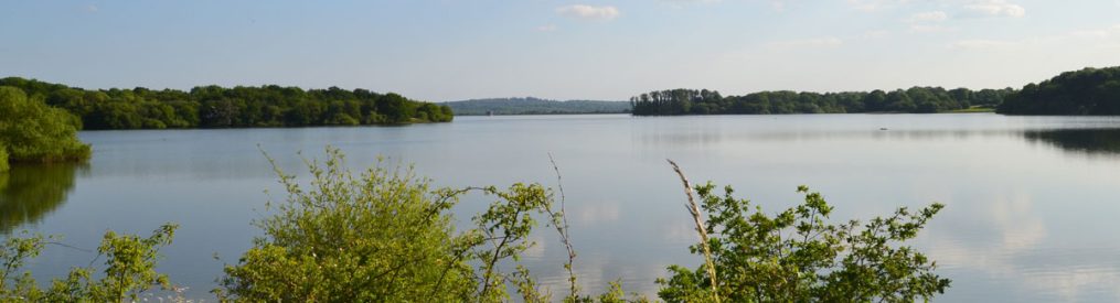
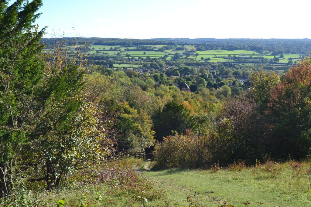
It’s been a bit of a classic autumn so far; lots of rain but also some great sunny windows of walking opportunity. If you’re keen on getting out for a walk but prefer to stay dry it means checking your weather apps and staying agile. Lately these windows have come at the end of the day and have rewarded those able to dash off on a Kent saunter late in the day with some brilliant light. On Saturday, the Downe walk at 5pm was a winner. As well as a beautiful sky, saturated colours and a sense of perfect tranquility, there were interesting birds around: kestrel, sparrowhawk, three yellowhammers, redwing and mistle thrush. Migrations are happening. Some of these birds may have travelled from Scandinavia, from eastern Europe, Yorkshire or a few miles over the border of Surrey. We’ll never know.
Rain set in overnight and for much of the next day. I’m drawn to wooded areas for walk in bad weather and few woodlands are better than Petts Wood, maintained by the National Trust. Scots pines, chestnut groves, heather glades, oak, ash, and sycamore surround a labyrinth of paths with a railway line and a couple of arable fields and streams helping navigation in the middle of the wood. A great place.
Reading around this subject recently it seems to me that to be safe it’s best not to do this at all with dogs. Cows can charge at people with dogs. The advice is that people should let go of the dogs but recent stories suggest that even this isn’t enough to prevent an attack. On most of the walks you can divert around the edges of fields or spot an alternative path. You’re almost certain to be fine if the herd is far away on the other side of the field; the problems seem to come if they are grazing around the path. Of course 99% of the time they just ignore you, or glare impolitely. But I suggest stay well clear even if without dogs. If with a dog, divert. On the walks at KWNL paths only cross fields with cows in them on the Chiddingstone walk (often but usually very far away on the other side of the field), Underriver walk (sometimes), and very occasionally on the Fackenden Down walk at Magpie Bottom and the top of the Down.
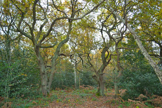
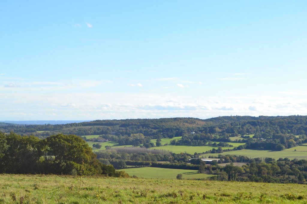
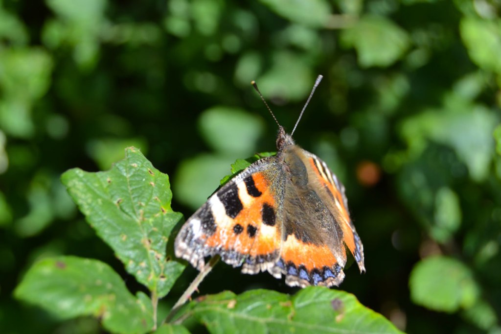
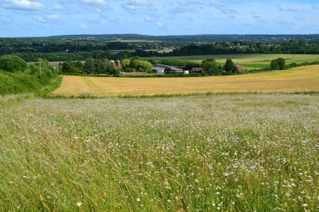
The Fackenden Down walk in late May on a breezy sunny day cannot be bettered. This is the walk on this site with most rewilding going on and plenty of Kent Wildlife Trust-maintained land. The results are a good variety of wildflowers, including several orchid species and sainfoin, lots of butterflies, burnet moths and birds such as buzzards (very common), whitethroat (from May to September) and yellowhammer (if you’re lucky). Some ancient species of livestock such as highland cattle are often used to graze the grasses in small numbers. My route is brilliant, if I do say so myself, and easily accessible by train. There’s a great pub at the end of the walk too – the Samuel Palmer.
I love Magpie Bottom in particular, a sheltered secret feeling valley alive with flowers and great variety of tree foliage colours. Then there the views from Fackenden Down itself, the wild “garden“ along the foot of White Hill and the Down, the view of London and Essex from the high point at Romney Street … it’s terrific, and a good workout with a few steep sections. It comes in at around 12,500 steps.
The Kent Wildlife Trust is in need of volunteers to monitor its livestock. Also it’s looking for urgent donations to enable it to purchase more land at Polhill, across the valley from Fackenden, where it monitors and maintains similarly superb chalk hillside. I’ve diverted the donations to this site to the appeal, but please make sure you chip in.
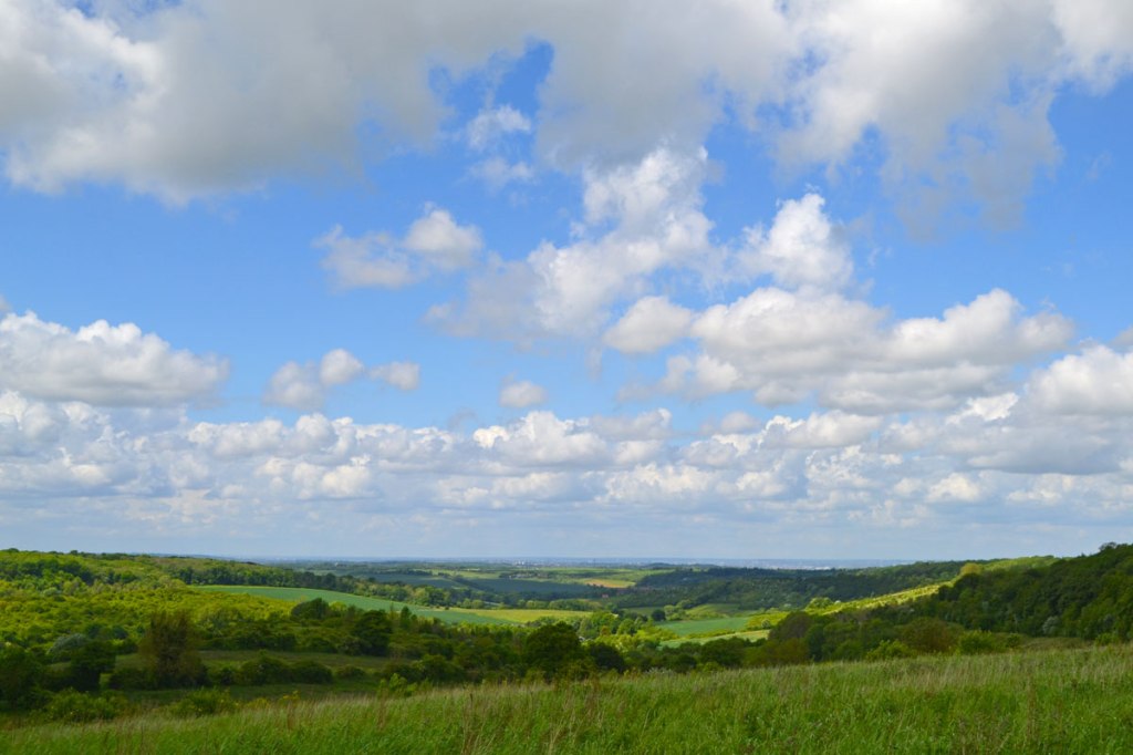
Spirits have fallen almost as steadily as the rain as we slipped mildly and humidly from winter to spring . The Met Office have gloomily talked of precipitation records being broken, and a sense of oppressive drudgery has undeniably taken root as indoor life seems the only option. Still, I’ve been impressed by the amount of runners and cyclists still out in the lengthy downpours, clocking up the miles. Me, I’m a fair weather fitness fan. A lot of the rain has been too heavy for walks; I’m happy in drizzle but the stuff that stings your face definitely takes the pleasure away at this time of year, though can be fun in summer. But hey, spring is around the corner somewhere, the temperatures are mild, the crocuses are out in the park and the daffodils gaily wave in the breeze. I love to walk on the Greensand Ridge at this time of year, to see signs of spring seeping into the colours of the miles of countryside stretching before you as far as the Ashdown Forest. It’s muddy, sure, but there’s also optimism in the snowdrops, primroses and sudden uptick in birdlife among the skeletal trees. Toy’s Hill south of Westerham has been fertile ground for walking.
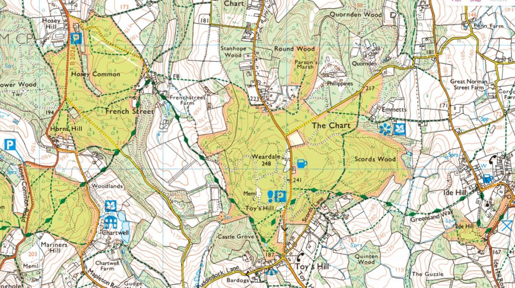
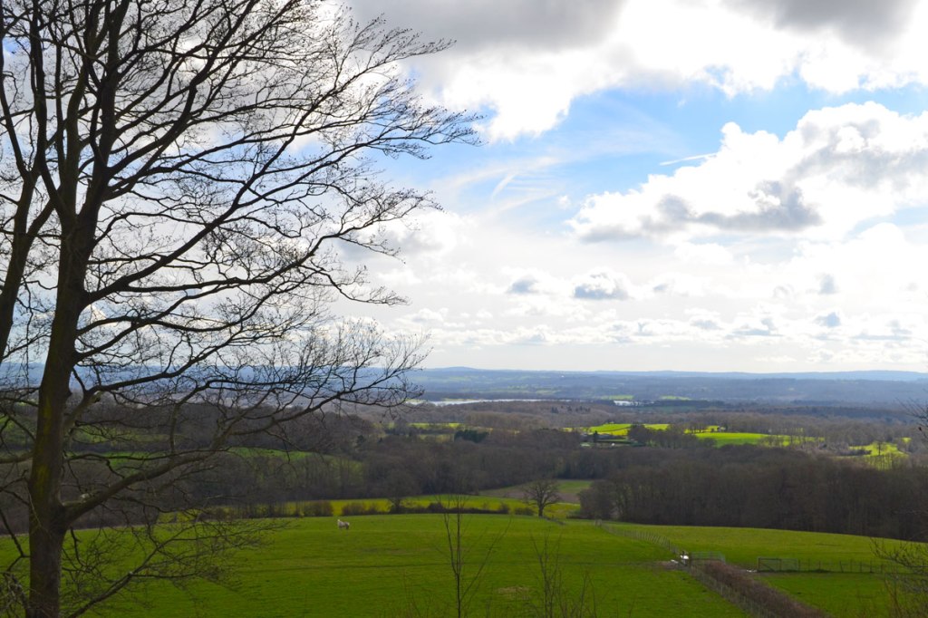
I haven’t got a Toy’s Hill walk on KWNL but there are several routes from the NT car park (the map above shows the car park, lower centre, and Toy’s Hill’s proximity to Hosey, Chartwell and Ide Hill) that are well signposted, such as the shortish Red Route, which will take you to Emmetts Garden and back. You can do my Ide Hill walk from Toy’s Hill easily enough, or even the Hosey Common route, but obviously you’ll be adding on a few miles. I really like the spot near the NT car park where the old mansion used to stand. From here you can see four counties including Leith Hill and even the South Downs on a fine day. The photos below were taken in early March; appearances change quickly at this time of year so expect less bleakness in the days ahead!
Four counties view from site of the demolished Weardale Manor, Toy’s Hill
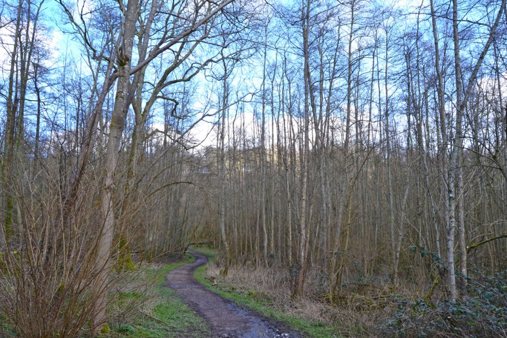
Ram Pump pond below Emmetts Garden in Scords Wood, on the Toy’s Hill red route and the Ide Hill walk
Scords Wood, awaiting signs of spring
This is the view south, to Bough Beech and Hever, from the point at which the Ide Hill walk joins the NT Toy’s Hill red route in Scords Wood
As for colour, look out for yellow lesser celandines, very spectacular at this time of year on the Fackenden Down walk in the woodland between the Down itself and Magpie Bottom. One of my favourite places for wildflowers in late March is on the Hever walk in the woods between Points 1 and 2, close to Hever Castle gardens (headline photograph). A yellow and white sheen seems to rise from the mossy forest carpet ushering in better days. But look if you want to keep your powder dry on the walking front, and not go out until mid-April and the blooming of the bluebells, that’s perfectly understandable.
A strangely mild January day; it looked as if it should have been cold and frosty. Instead, the late afternoon breeze wafting into the sunny North Downs escarpment at Knockholt Pound was tonally of southern Europe. I’d finished various tasks (which included watching tennis and football) by 2pm, which is about the cut off for setting off for a Kent Walk Near London in late January when darkness descends by 5.30pm. I found that even as dusk fell there were still carefree buzzards and kites drifting on the thermals across the dips and dry valleys, over sheep whose outlines caught the last of the sun making them appear luminous. As the sun set there was a gentle fall in temperature but by the time I reached the car there was still no real bite to the air and I reflected on the fact I could feasibly have done the whole walk in my T-shirt. It also occurred to me that I had encountered only one other person over the three miles of the route.
This route, no 28, is similar to walk 27, but is better for people walking on Sundays, when there is no train service. You can start it from the lovely Chequers Inn, Heaverham (if you buy a drink/meal); Kemsing village car park; or Mon-Sat from Kemsing station. Rather like the Chevening/Knockholt walk it’s another chalk escarpment route that drops down into the Vale of Holmesdale, and uses short stretches of the North Downs Way. The link below includes the usual Google map and the more useful OS map, plus written directions. PDF to download will follow in a few days!
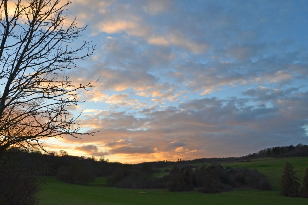
It’s proved an unexpectedly dry month, which has meant less mud when walking at this time of year than in any February I can remember (I don’t take measurements to be fair). There have been some gloomy weekends but some bright ones too leading to loose talk of spring having sprung. It hasn’t. Appreciating the longer daylight hours, we headed off in late afternoon for a circuit of Lullingstone yesterday, taking in the superb Beechen woods, the views down the Darent Valley and the blackthorn/hawthorn-dotted grassy high chalk hillsides on the return (we’d started the walk from the golf club car park, not the visitor’s centre). The cloud-shrouded sunset was magnificent with glimpses of Jupiter and Venus in the twilight. Very few birds around apart from a few fieldfare feeding late on the eighth hole fairway in the gloom. The last golfers had gone and with few people around it was all very tranquil, leaving a lovely imprint on the memory that will last me through the week.
Exceptionally mild temperatures have lured bats out into the autumnal gloaming to catch late flying insects. I love watching these animals swoop, flutter and flit around and it’s a bonus to see them so late in the year. Usually you can only pick them out against the sky but at Downe and Keston on last weekend’s strolls I was buzzed by bats so closely I sensed rather than saw them zooming past. Yesterday at Polhill one or two emerged from the mist to pass close over our heads before vanishing into the gloom.
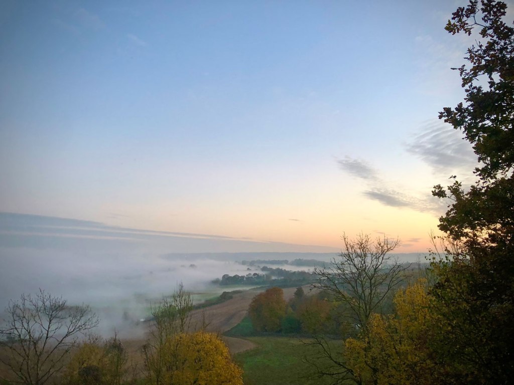
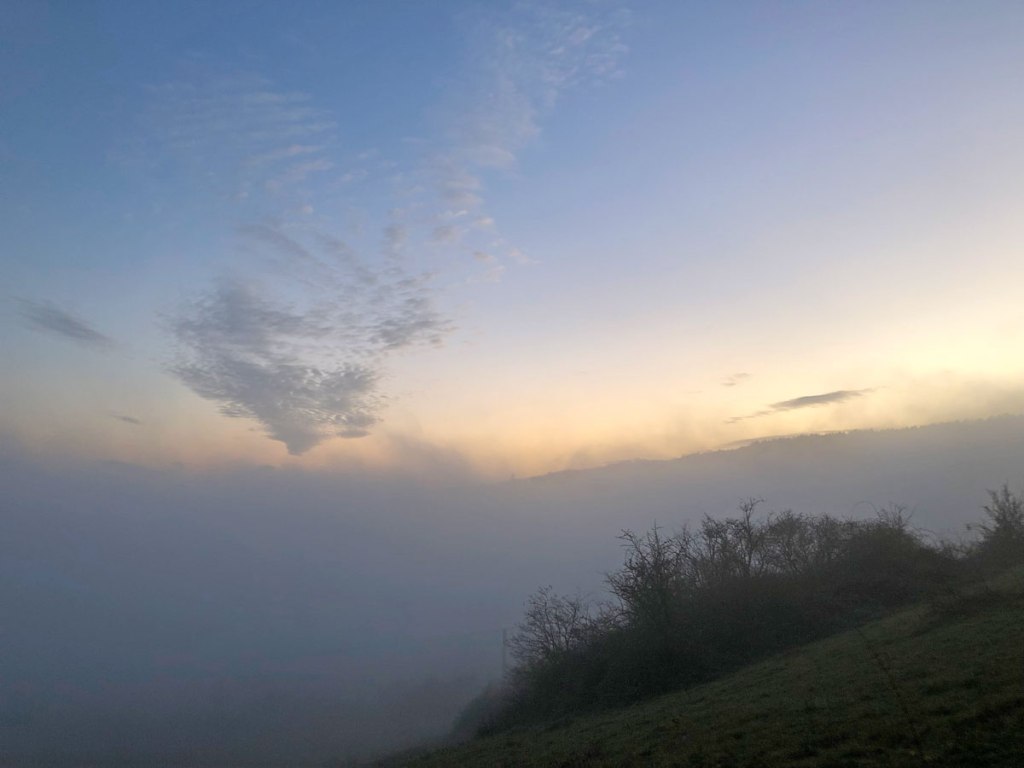
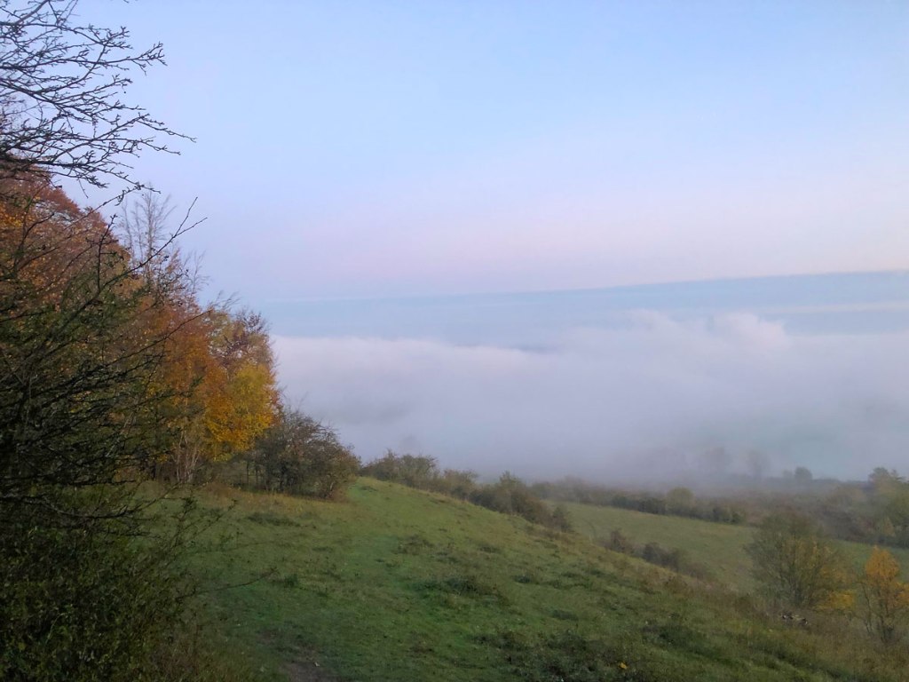
I’d thought we’d set off rather too late for a walk. Traffic was bad on the A21 slowing us further (the train is by far the best option for Shoreham walks) and low cloud had covered the sky. But by Locksbottom the skies cleared and we were bathed in a beautiful golden light. This was a false dawn: by the time we parked up by Meenfield Woods above Shoreham we were in quite dense fog. This magically cleared at Polhill, the walk’s halfway point, to give us unusual views before swirling back in as the sun set. With the mist below we had the feeling we were much higher above the valley than we were. I think this weather effect is called a temperature inversion, where warmer air passes over the relatively cold air on the valley floor, causing condensation.
By the time we finished the walk, visibility was down to about 50 metres and driving home the twisty, twiny country lanes needed total concentration if we were to avoid a close encounter with a hedgerow.
Mist obscures Sevenoaks, pictured from Polhill, November 2022
Mist at Polhill swirls in as the sun sets. Looking towards Knockholt and Chevening. November 2022
Mist at Polhill looking towards Otford, November 2022
What a wonderful walk today. The Oldbury-Ightham-Stone Street jaunt is a bit of an epic by KWNL standards at 6 miles, but every metre is worthwhile. I started badly, however, by telling a group of mountain bike riders they were wrongly cycling on a footpath. I was sure I was right but it turned out I was wrong. It was a bridlepath and they were fully entitled to ride on it. It wasn’t an unpleasant exchange and it was quite funny that I had to admit I was wrong after being shown the map. I ended up saying “Well I haven’t seen any horses, have you?” but I was trying not to laugh. I’m a country lane cyclist myself; I can’t understand cycling down paths and bumping over roots and being brushed by nettles. And I can’t understand cyclists steaming or wobbling down main roads with queues of nervous car drivers behind them. For me, the whole point is a bit of peace and quiet. But that’s me. Live and let live I say; each to their own.
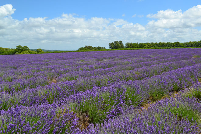
I hadn’t done this walk since Covid. My friend Steve introduced me to it in July 2020. The lavender has been largely harvested but as a result, on that section of the walk I didn’t pass a soul. Interestingly the springs of the Greensand Ridge seemed to be unaffected by the dry and hot weather, so ponds were looking healthy-ish, and the little streams near Ightham tinkled beautifully.
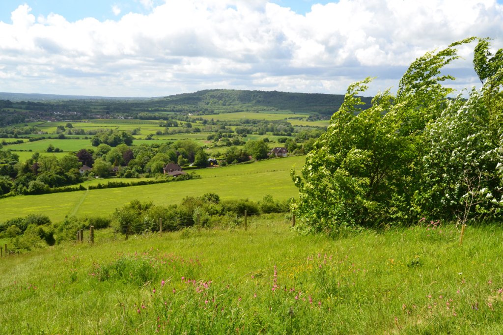
One of the oddities of the walk is that despite being on the Greensand Ridge you don’t get the same extensive Weald of Kent views that you do further west, at One Tree Hill and around Ide Hill. There are just too many trees in the way! But I did get great views of the Spitfires from Biggin Hill on their joyride flights; they seem to use this area to break away from the accompanying photo plane.
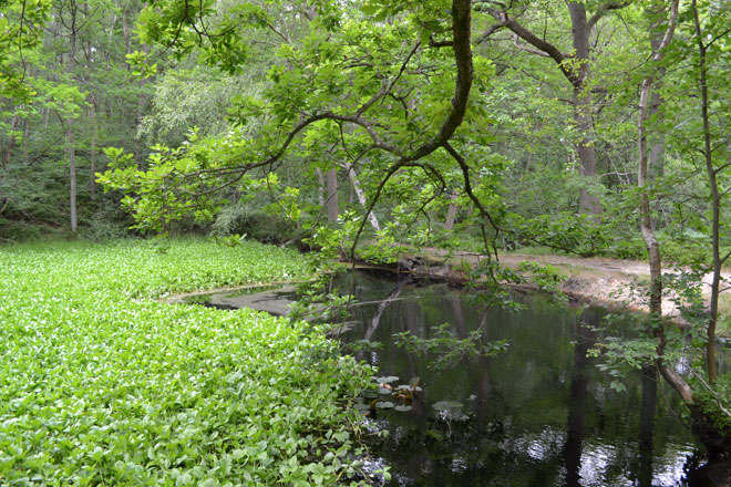
Pond at Point 1-2
Oldbury woods cover an iron age fort. It’s easy to see how this would have been a fortification in the centuries leading up to the Roman invasion but surely the Britons must have chopped down loads of trees to give themselves a field of view.
There is a similar feature at Keston, just south of the ponds. Navigation is not so straightforward at two points: between Stone Street hamlet and St Lawrence’s Church, and on Oldbury Hill itself, so check the GPX. Despite going slightly wrong twice (but quickly getting back on track thanks to the OS GPX) I was back home for the very enjoyable England v Germany football final – an excellent end to the afternoon. It’s a great walk, I really recommend it.
Mitchell and Peach lavender, point 3-4 pictured in early July 2020 – it’s harvested by August (earlier, if it’s been hot)
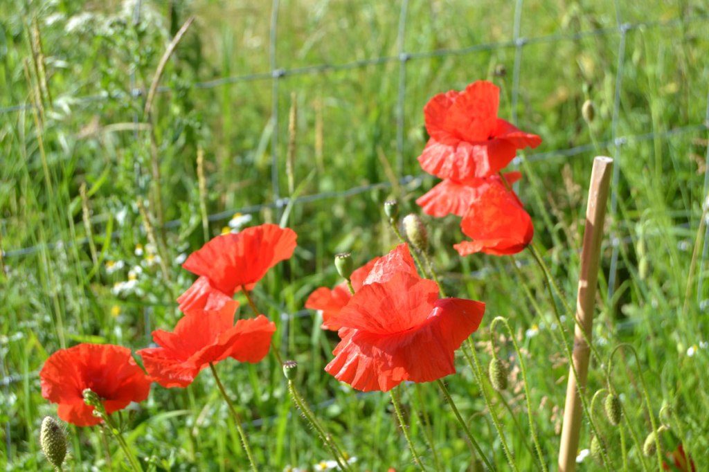
Continuing the theme of overlooked walks at Kent Walks Near London, the Polhill Pluto route yesterday proved the perfect choice on a bright, breezy summer’s day. There were plentiful orchids in the Andrews Wood-Meenfield Wood gap and fantastic ox-eye daisies, scabious and poppies in the fields below Polhill. It’s a great walk to do if you are a fan of the yellowhammer – the colourful, chirpy bunting (we’re talking about a bird by the way!) that adorns hedgerows in these parts and is particularly common for some reason between Shoreham and Otford. It’s repetitive and unworldy song is one of my favourites – it’s commonly described as sounding like ‘a little bit of bread and no cheese’ because of its rhythms but to me it’s simply the sound of summer. Listen out for it on the Darent Valley floor; around Sepham Farm it’s nearly always heard, and sometimes present in the lower parts of the Fackenden and Eastern Valleys route (such as around the Percy Pilcher memorial). The Pluto route (so called because you pass the final ‘planet’ on the Otford solar system scale model) can be combined with the Shoreham circular and even the Fackenden, Otford and Eastern Valley routes for a walk of up to 11 miles or so as all these routes intersect, or almost intersect, at various points. For some reason, I only think of this stroll as a summer walk – not entirely rationally, but it just feels right on a warm day.