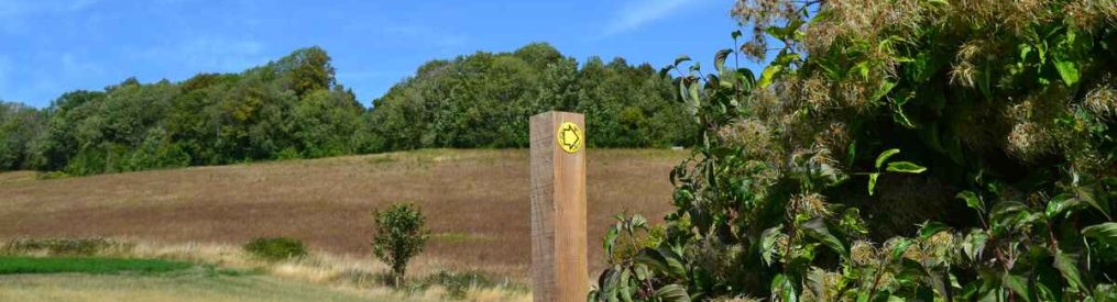
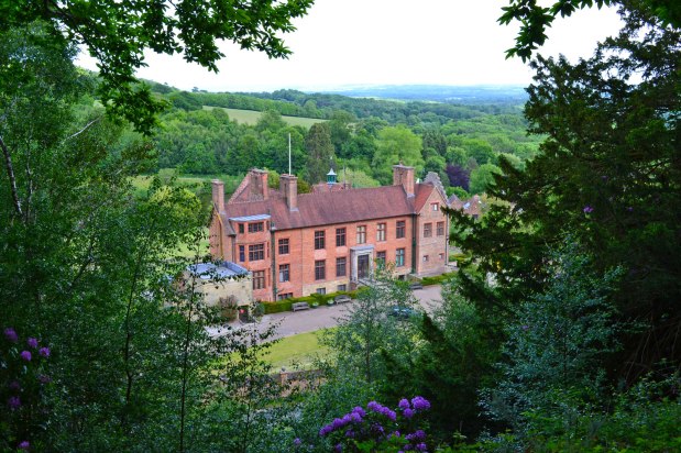
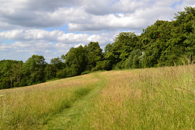
I was introduced to this Oldbury/Ightham Mote/Stone Street circular route recently by a friend, who has a weathered book of Kent walks. In the book it starts at Ightham Mote National Trust car park, but that is no longer available to walkers (you have to book a ticket to visit the Mote now). So this one starts at the NT car park on Oldbury Hill, in Styants Bottom Lane just off the A25. It’s got some fantastic woodland and right now, brilliant lavender fields high on the Greensand Ridge, but these are due to be harvested by the end of the month so don’t delay if you like the sweet-smelling purple stuff. There are no stiles but there are some short steep sections, one – on Raspit Hill – has giant steps probably put in to prevent erosion rather than to assist walkers. I found them tough on my post-cruciate ligament twang knees. It’s a lovely stroll with a hilltop fort from prehistory. Beautiful Ightham Mote is a short detour, St Lawrence’s Church is a great spot and there are a few nice hamlets and decent views. It’s a mile longer than most of the walks on this site, but it doesn’t feel long if you know what I mean. The picture above is of Point 6, just before entering the Oldbury Hill hillfort woods. There is a GPX map here… ignore the chequered flag, the result of me recording the route ending at Ightham Mote instead of Oldbury Hill. Below is a Google Maps representation of the route… it’s an odd shape isn’t it, but hey…
summer walks
Let’s hear it for foxgloves (and rosebay willow)
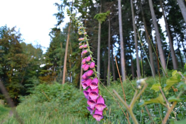
People (like me) go on about orchids but undeniably our most spectacular native flower is the foxglove. Agreed? They’re flowering now and bees love ’em. Maybe it’s because they’re not rare they don’t get quite the attention all the little more obscure ones receive. So what are the best walks on this site for foxgloves? Ide Hill, Chiddingstone, One Tree Hill, Hever, Hosey Common/Westerham. Most will have stopped flowering by mid-July I’d guess. It’s a beautiful flower but highly toxic – and our distant ancestors associated it with evil because of this toxicity, calling places where it appeared ‘Witches’ Grove’ and the like. It really can cause harm, including heartbeat fluctuations, vomiting, blurred vision and collapse. However, its digitalin chemical, which gives it these qualities, is also used to treat heart conditions. Besides, it’s very pretty – if you like pink – so let’s move on from all that.
It particularly likes lighter acidic soils and seems to thrive in woodland gaps, glades and recently cleared land. I’d say it’s more a flower of the Greensand Ridge than the North Downs chalk though you can find it in the woods and hedgerows of the latter.
Also spectacular from now until August is rosebay willow herb. Just as tall as foxgloves this beautiful flower grows even more abundantly on the walks than foxgloves. There’s one particularly impressive ‘forest’ of rosebay willow on One Tree Hill, just behind the famous viewpoint, in a glade.
Meadow mystery magic and a forgotten aviator
I’d only ever done Walk 14 (Shoreham’s ‘mysterious’ eastern valleys) in winter and autumn prior to today. It then had a lonely, almost eerie quality. I’d assumed it would be busier but my friend and I were alone as we traversed fantastic woodland and wildflower meadows, and yes, it still had that timeless feeling of loneliness. Dark green fritillary butterflies and commas were seen as were bee orchids, fragrant orchids and fields of poppies and thistle.
After the hamlet at Austin Lodge we made it up the hill to the Percy Pilcher memorial; a beautiful spot overlooking a typical North Downs dry valley. Pilcher was a 19th-century glider designer and pilot who tested many of his designs right here, a couple of miles south of Eynsford. He was poised to become the first man in the world to achieve powered heavier than air flight but crashed and died in the south Midlands flying his Hawk glider before he could get his powered machine – a revolutionary triplane – in the air. Pilcher would have beaten the Wright Brothers by four years had he succeeded. A more impressive monument to the great man was put up at Stanford Hall, Leicestershire, scene of his last crash, but the one near Eynsford (pictured below) felt perfect in the hush of this breezy, warm day.
One day in 1897 Pilcher let his cousin Dorothy Rose Pilcher take the controls of his Hawk glider – probably the first time a woman had flown a heavier-than-air-aircraft. She flew down the hill and collided with a man operating a cinematograph camera. I reckon it was his fault but no one was hurt thankfully.
A great thing about this walk is that it starts right by Shoreham (Kent) station (obviously an even better thing once the pandemic is over, whatever that means). Please don’t try to get to the Pilcher memorial by car; there’s no parking at Austin Lodge and the whole essence of this remarkable place is its tranquility. You can park the car by Shoreham station (please avoid driving through the village which can get snarled up and spoilt by traffic) for free if you feel the train service is unsafe for Covid-19 reasons.
Learn more about Percy Pilcher.
A weald of possibility
Just before the great May weather ended we headed down to the Kent low weald, to Chiddingstone for a walk. Usually there are quite a lot of tourists and daytrippers (like myself) in the Tudor one-street village which has the air of a film set (it was used in Room with a View among other films). But under lockdown restrictions very little stirred beneath the cloudless sky; the lovely Castle Inn was closed of course and there was rather an enchanting air of abandonment. The walk itself was subdued too; I had been hoping for cuckoos calling and sightings of house martins, bullfinches and swallows. But the restrictions seemed to have spread to the wildlife too and there was little to be seen or heard. One of the best things about walks at this time of year though was in full swing… groves of flowering foxgloves. I love ’em.
I’ve always wanted to find a way of avoiding walking along the road between points 6 and 7, so we took a detour into the parkland at Penshurst Place to examine the possibilities. Alas there is no side path that connects with the footpath at point 7. It’s a shame because it wouldn’t be too hard to set up a gate in the metal fence at that point and establish a little path. Still, it is possible to walk in the parkland for a couple of hundred metres before you have to rejoin the road; it’s something I suppose, and there was a nice view of the ancient manor house from there. We also did the Bough Beech walk nearby which despite its brevity always surprises me with how much beauty it packs in.
New(ish) walking route – Hosey Common and Chartwell circular
The new Walk 21 a shorter version of Walk 15, starting up the road from Westerham at the free car park at Hosey Common. It includes a lovely stretch by the stream of the Darent soon after its emergence as a spring. If you don’t drive it’s easiest to get to Westerham on the 246 bus which connects the town with Bromley, Hayes and Keston. You can then join this walk between points 8 and 9 having started it from the green at Westerham (as per Walk 15). There’s a GPS map link included.
The route is about a mile shorter than Walk 15 (3.9 miles as opposed to 5 miles) but has the same great views at Chartwell and Mariners Hill. Kent Wildlife Trust has a great resource if you really want to get down and dirty with the trees, species, geology and topography of the area. The walk is part of the Greensand Ridge… so a companion to routes on this site at Ide Hill, Ightham Mote, One Tree Hill and Knole (see menu, top). There are so many paths that with a map it’s easy to customise the walks to your own requirements, but I think this route captures the best of the area’s great woods, views and valleys.
Thanks and best wishes to all readers… let’s get walking again
First of all, I wish all the best to Kent Walks near London readers as we all try to get through this period unscathed in terms of our health, your livelihoods and sense of wellbeing. To those who have had or still have Covid-19, many sympathies – it sounds horrendous in many cases. The countryside is slowly opening up, but we should all be mindful of social distancing and try to make way for each other on narrow paths. Let’s avoid overcrowding in good weather and take wipes for handling gates and stiles if possible.
Second thing, thanks to all those who have donated to this website… entirely voluntary so a heartfelt thanks from me. It’s only a small amount of course but it will help me produce more walks, better mapping and information and some will be going to charities too. There are adverts on the site too, you’ll see, but a niche page like this is never going to pull in the big bucks from the AdWords model so it’s little more than a token gesture towards commerciality. Maybe display ads from dedicated sources – outdoor retailers, pubs, or as you are about to read, apps – may be the way forward.
Oh, and please check out the Kent Wildlife Trust website. KWT manages some of the woods and sites on here (as does the Woodland Trust), helping maintain the paths and creating brilliant areas for flora and fauna. It deserves our full support (and donations right now).
’appy days with wildflower apps
Out and about for the first time in a while at the weekend made me reflect that May, June and July are probably the best times of year for trying to work out what kinds of wildflowers you hopefully aren’t trampling over.
Many wildflowers aren’t that spectacular compared with cultivated garden plants and we sort of take them for granted. But notice how, unlike some of our garden species, they don’t seem to suffer from the dry conditions so much.
Until recently I only knew obvious ones: cow parsley, buttercup, ox-eye daisy, buttercup, pyramidal orchid, etc. I was a blooming ignoramus you might say. But I started adding to my list by asking friends, looking at my dear departed mama’s old, faded book of illustrations (complete with samples turning to dust) and looking at websites. I half remembered things my mum told me as a kid, so pretty soon I could identify scabious, red campion and the like. And the more you keep an eye out and record, the more interesting the whole caboodle becomes. You start to appreciate the shy little flowers of the woods, meadows and margins, their colour and what they give to various creatures.

Common spotted orchid and trefoil, White Hill, Shoreham, on the Fackenden Down walk (in June 2019)
But by downloading the Picture This app on my phone (there are other similar tools too in the App Store, such as the excellent iNaturalist which I’ve also used) I’ve revolutionised my learning. The app compares your photos with its database pictures in seconds to tell you what you’re looking at. This has helped me identify stitchwort, bugle, white helleborine, yellow pimpernel, archangel, ground ivy, vetch, sainfoin, trefoil and milkwort, among others. It does tree leaves too. I’ve been quite oblivious to all this stuff for a long time, so please forgive my excitement.
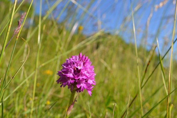
Soon, an abundance of orchids will appear in places like Polhill Bank, Fackenden Down, Lullingstone, Magpie Bottom (see Walks on the menu above) and I can’t wait to get stuck into working out what’s what. The walks on this site are excellent for flora with chalky soils predominating on the North Downs; sandy soils on the Greensand Ridge and Weald routes.
I suppose flowery stuff is not the most useful information you’ll pick up in life but I find being able to identify wildflowers really does pique my interest and triggers curiosity about other things too… insects, birds and how our ancestors used these plants. It also makes up for the fact I am a pretty useless gardener.
Awesome orchid wonderland
I was bowled over by the wildflowers on the Fackenden Down walk yesterday. I’ve never seen so many orchids; with yellow trefoil and tall ox-eye daisies blazing away as a background some of the meadows were mesmerising. Full credit to those managing the sites of special scientific interest at Magpie Bottom, Austin Spring and Fackenden Down along to White Hill (Kent Wildlife Trust in conjunction with local landowners?). Their hard work has produced a superb return. I’m not good at identifying orchids beyond the pyramidal variety, but I’ll give it a shot for the photos.
To strike a more negative note, I got the feeling there should still be more insects enjoying this abundance; there were plenty of bees around but not a lot else (a few marbled white butterflies, the odd peacock butterfly and red admiral notwithstanding). There was a distinct lack of swallows, martins and swifts, too. These species haven’t made it to these shores in great numbers this year it seems and that could be because of the effect of insecticides. But anyway, a beautiful and memorable walk.
And remember, this wonderland is only 50 minutes direct on the train from Peckham Rye, with the walk starting opposite Shoreham station.
Downe Downe deeper Downe
I’ve always liked that Status Quo song ever since I was a young teenager. I’m no headbanger but it’s got energy and drive – which Kent walkers have in abundance of course.
GPX dodgy and iffy instructions
I did both Downe walks this weekend. The weather was distinctly iffy so I couldn’t be bothered to go far. So I did the new longer Downe walk on Saturday and the usual shorter one on Sunday with my wife. She was not too impressed by my instructions; “too wordy” she said in a slightly irritated fashion after about 50 yards. My attention was somewhat distracted by a B-17 Flying Fortress flying low overhead, but then she pointed out I had omitted to mention any stiles and gates and thought my ‘line of trees’ was really a wood. It made me realise that we all see things a bit differently and that I’m so familiar with the walk that I was imagining rather than actually seeing. That’s quite a phenomenon – try describing your walk to the station or to the office… it’s so obvious to you but you suddenly realise that you’ve completely misdescribed a house or a shop.
Compounding the unclear directions is the uncomfortable fact that the GPX tracks I’m pointing people to on the website are distinctly dodgy. On Saturday it was only right 50% of the time; often the blue dot marking your ‘live’ location would linger unhappily in a nearby road or layby. No idea why. Could be a signal thing or a sign you are running out of data, a position I’m very familiar with. Today, on the short Downe walk, the GPX was inaccurate the whole time. I’ll have to redo the track, maybe using a different website but then there might just be something about Downe, deeper Downe.
Here’s the pdf for the new instructions for Walk 1 Downe Circular. Gratitude to my wife for opening my eyes and apologies to anyone I’ve misled. And here is, hopefully, a more reliable GPX track.
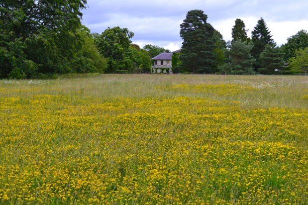
By the way, I’ve learnt a new wildflower name and I’m going to use it. Birds-foot-trefoil. It’s small and yellow and spectacular at Downe, particularly in the meadows close to Darwin’s house (of course!). Apparently the plant is a staple in the diet of caterpillars of common blue, silver-studded blue and wood white butterflies. There are also pyramidal orchids at the moment in the the hillside fields that end the walk.

Hillside field point 7-8, Downe
A longer Downe route – my walk 20
Here’s a longer Downe route to follow; double the length of the existing Downe walk at 4.2 miles, so a pleasant 90-minute walk. See, download pdf or use GPX track from this page
It can be viewed on the GPSies site where a GPX track is available for you to download and follow on your smartphone (to get your real-time location tap the bottom-most button on the left of the screen).
The route starts and finishes at the same locations as the original Downe walk. The extension misses out on the lovely fields by Charles Darwin’s garden (although they are an easy detour away) and the Sandwalk but gains the superb ancient woods of Blackbush and Twenty Acre Shaw Woods with its superb April bluebells then orchids and gentians.

Ancient woods: Blackbush and Twenty Acre Shaw
Yesterday the trees were rich with the calls of song thrush, chaffinch and wrens (so loud… and weird!). A sharp thundery looking storm slipped by to the south, on its way to Tonbridge and Sevenoaks (pictured). After the woods the walk joins the valley on the eastern border of the historic Biggin Hill airfield. Hedgerows, giant beeches and wild meadows make this a really rich looking habitat for flora and fauna; yesterday I saw nuthatches, greater spotted woodpeckers and a wonderful large tortoiseshell butterfly. Full description of walk here, but the GPX track should get you round easily enough.
Next walk to be added to this site: Knockholt Pound/Chevening circular. By end of June.
Fabulous Fackenden
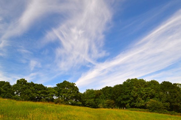
The Fackenden Down walk is such a winner at all times of year – and it’s so easy to get to from SE London, because it starts right outside Shoreham train station. In yesterday’s perfect weather wildflowers illuminated the hillsides and meadows; cirrus clouds offered a dramatic dreamscape high above and incessant birdsong filled the air. So many highlights on this walk: the bit when you leave the ancient beech wood and enter the timeless Magpie Bottom valley is my favourite. And the distant views of the City and the Shard from Romney Street are dramatic too. I was disappointed to see my team lose in the Champions League final later on (yet so thankful we got to the final) but the memories of the walk compensated. I created a GPX track of the walk too… so going off-route is now impossible (if you have a smartphone that is). The walk does have some steep sections though, so take it easy.
Interactive pdf of walk (to print or download on phone) is here.